Category:Maps showing the 560s
Jump to navigation
Jump to search
Subcategories
This category has the following 2 subcategories, out of 2 total.
- Maps showing 568 (1 F)
Media in category "Maps showing the 560s"
The following 21 files are in this category, out of 21 total.
-
Alodia 565ad.jpg 998 × 619; 233 KB
-
Asia 565ad.jpg 2,379 × 1,291; 448 KB
-
Exarchates 560.png 1,590 × 871; 315 KB
-
Hispania 560 AD SVG.svg 2,499 × 2,499; 206 KB
-
Hispania 560 AD.PNG 2,500 × 2,500; 250 KB
-
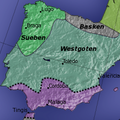
Hispania 565.png 238 × 238; 74 KB
-
Hispania3c-ca.svg 1,262 × 1,053; 569 KB
-
Hispania3c-es.svg 1,262 × 1,053; 542 KB
-
Hispania3c.JPG 883 × 667; 154 KB
-
Iberia 560 AR.png 1,200 × 990; 205 KB
-
Iberia 560-es.svg 924 × 762; 172 KB
-
Iberia 560-pt.svg 924 × 762; 161 KB
-
Iberia 560-ru.svg 924 × 762; 383 KB
-
Iberia 560-zh.svg 1,155 × 953; 171 KB
-
Iberia 560.svg 924 × 762; 315 KB
-
Lingue impero bizantino 565.JPG 906 × 409; 86 KB
-
NE 565ad.jpg 1,477 × 973; 226 KB
-
Roman-Persian Frontier, 565 AD-es.svg 512 × 460; 1.57 MB
-
Roman-Persian Frontier, 565 AD-pt.svg 512 × 460; 83 KB
-
Roman-Persian Frontier, 565 AD-zh.svg 1,875 × 1,685; 344 KB
-
Roman-Persian Frontier, 565 AD.png 838 × 775; 1.86 MB


