Category:Maps showing the 1870s
Jump to navigation
Jump to search
| Maps showing the 19th century:
←1800s 1810s 1820s 1830s 1840s 1850s 1860s 1870s 1880s 1890s → |
Not to be confused with maps made in the 1870s.
Subcategories
This category has the following 9 subcategories, out of 9 total.
- Maps showing 1870 (6 F)
- Maps showing 1871 (2 F)
Media in category "Maps showing the 1870s"
The following 2 files are in this category, out of 2 total.
-
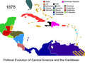 Political Evolution of Central America and the Caribbean 1878 na.png 1,000 × 750; 127 KB
-
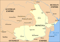 Romania 1859-1878.png 588 × 413; 75 KB

