Category:Maps showing 2nd-century BC history
Jump to navigation
Jump to search
| Preceded by: 3rd century BC maps |
2nd century BC maps 200 BC-101 BC |
Succeeded by: 1st century BC maps |
Subcategories
This category has the following 6 subcategories, out of 6 total.
Media in category "Maps showing 2nd-century BC history"
The following 95 files are in this category, out of 95 total.
-
200bc2ndMacedonianwar.png 572 × 471; 337 KB
-
294 of 'A History of Rome to the death of Cæsar' (11237734466).jpg 2,016 × 1,250; 563 KB
-
Achean league 150aC-it.svg 785 × 509; 6.25 MB
-
Achean league 150aC-pt.svg 785 × 509; 6.25 MB
-
Alter Orient 0200BC-es.svg 2,102 × 1,510; 3.64 MB
-
Alter Orient 0200BC.svg 2,102 × 1,510; 4.9 MB
-
Alter Orient+Persien 200BC.svg 3,100 × 1,960; 7.38 MB
-
Anatolia 264.jpg 823 × 513; 191 KB
-
Ancient World 200 BC (German text) SVG.svg 512 × 391; 191 KB
-
Ancient World 200 BC (German text).png 1,125 × 870; 59 KB
-
Asia Minor 188 BCE.jpg 1,045 × 572; 483 KB
-
AsiamenorEn188AC.svg 989 × 542; 189 KB
-
AsiamenorEn188ACSinColores.svg 3,272 × 1,785; 563 KB
-
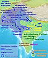
AtlasIndoGreek.jpg 1,200 × 1,440; 359 KB
-
Battle of Elasa.png 3,360 × 1,652; 151 KB
-
Bellum-Asturicum-Cantabricum.png 1,147 × 686; 58 KB
-
CentralAsia 100bc.jpg 989 × 568; 178 KB
-
Crimea 2nd century BC map hu.svg 1,000 × 779; 228 KB
-
Crimea 2nd century BC map-es.svg 1,070 × 843; 508 KB
-
Crimea 2nd century BC map.png 430 × 335; 30 KB
-
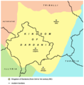
Dardania kingdom-sr.png 877 × 894; 48 KB
-
Dardania kingdom.png 877 × 894; 51 KB
-
Espansione di Roma, 2° secolo a.C..gif 738 × 567; 34 KB
-
Expansion of Rome, 2nd century BC fi.gif 738 × 567; 40 KB
-
Expansion of Rome, 2nd century BC Only.png 735 × 564; 31 KB
-
Expansion of Rome, 2nd century BC.gif 732 × 561; 36 KB
-
Fifth Syrian War.png 613 × 435; 291 KB
-
Getae 200bc.jpg 549 × 415; 95 KB
-
Gracchan land distributions.svg 1,116 × 653; 614 KB
-
Grecia 188.jpg 538 × 392; 33 KB
-
Grecia 194.jpg 536 × 391; 32 KB
-
Greco-BactrianKingdomMap-af.svg 1,494 × 824; 379 KB
-
Greco-BactrianKingdomMap-el.png 1,500 × 1,038; 2.36 MB
-
Greco-BactrianKingdomMap-es.svg 1,494 × 824; 379 KB
-
Greco-BactrianKingdomMap-fr.svg 1,494 × 824; 379 KB
-
Heinrich Kiepert. Imperia Persarum et Macedonum. 1903 (A).jpg 7,106 × 5,587; 6.74 MB
-
Heinrich Kiepert. Imperia Persarum et Macedonum. 1903 (C).jpg 1,883 × 1,199; 1.6 MB
-
Heinrich Kiepert. Imperia Persarum et Macedonum. 1903.jpg 7,993 × 6,198; 6.79 MB
-
Hellenistic world 200BC blank.png 2,000 × 961; 2.08 MB
-
Judea-Maccabees-Battles.png 3,220 × 2,049; 336 KB
-
Karte Makedoniens 200 vC-de.svg 993 × 794; 4.12 MB
-
Kleinasien I.jpg 3,053 × 1,706; 886 KB
-
La Guerra Acaica en 146 aC-es.svg 2,069 × 1,771; 6.02 MB
-
La Guerra Acaica en 146 aC.jpg 537 × 392; 59 KB
-
La Liga aquea en 150 aC-pt.svg 2,201 × 1,280; 214 KB
-
La Liga aquea en 150 aC.jpg 536 × 392; 61 KB
-
La Liga aquea en 150 aC.svg 1,848 × 1,252; 2.79 MB
-
La Liga aquea en 194 aC.svg 1,848 × 1,252; 2.78 MB
-
La-Liga-aquea-He-150-aC.png 536 × 392; 54 KB
-
Licia helenistica 200 BC.PNG 712 × 582; 351 KB
-
Licia helenistica 200 BC.svg 852 × 710; 2.65 MB
-
Literacy.PNG 530 × 344; 12 KB
-
Macedonia and the Aegean World c.200 el.png 750 × 599; 385 KB
-
Macedonia and the Aegean World c.200.png 750 × 599; 414 KB
-
Map Macedonia 200 BC-bg.svg 993 × 794; 3.44 MB
-
Map Macedonia 200 BC-ca.svg 993 × 794; 3.42 MB
-
Map Macedonia 200 BC-el.svg 993 × 794; 3.49 MB
-
Map Macedonia 200 BC-es.svg 992 × 794; 4.03 MB
-
Map Macedonia 200 BC-fr.svg 993 × 794; 3.51 MB
-
Map Macedonia 200 BC-it.svg 993 × 794; 2.78 MB
-
Map Macedonia 200 BC-mk.svg 993 × 794; 3.72 MB
-
Map Macedonia 200 BC-pt.svg 993 × 794; 3.41 MB
-
Map Macedonia 200 BC-ru.svg 993 × 794; 3.44 MB
-
Map Macedonia 200 BC-sr.svg 993 × 794; 3.52 MB
-
Map Macedonia 200 BC-ua.svg 993 × 794; 3.44 MB
-
Map of the Kingdom of Gentius in 169 BC (Hungarian).png 1,731 × 1,015; 2.39 MB
-
Map of the Kingdom of Gentius of the Ardiaei (English).svg 1,600 × 1,600; 6.39 MB
-
Map of the Kingdom of Gentius of the Ardiaei (Portuguese).svg 1,600 × 1,600; 6.39 MB
-
Map of the Third Illyrian War 168 BC (hu).png 585 × 861; 732 KB
-
Mappa di Eratostene.jpg 5,085 × 3,096; 2.37 MB
-
NE 200bc.jpg 1,474 × 1,148; 512 KB
-
PtolemaicEmpireinArabic.PNG 1,979 × 951; 2.48 MB
-
Putz110.jpg 800 × 385; 104 KB
-
Putz13.jpg 1,787 × 957; 172 KB
-
Roma in Oriente 127aC.png 2,425 × 1,581; 3.3 MB
-
Roman-Syrian-War it.png 2,079 × 1,339; 475 KB
-
Roman-Syrian-War.png 2,079 × 1,339; 457 KB
-
Rooma190eaa.png 946 × 496; 56 KB
-
Rothert, Bd1Bl20K1 - Zweiter Makedonischer Krieg 200-197.jpg 1,663 × 1,642; 584 KB
-
Rothert, Bd1Bl20K2 - Dritter Macedonischer Krieg 171-168.jpg 1,533 × 1,183; 379 KB
-
Rothert, Bd1Bl20K3 - Der syrische Krieg 192-189.jpg 2,081 × 1,702; 662 KB
-
SegundaGuerraMacedónicaSimplificada.svg 992 × 794; 1.47 MB
-
Seleucid-Empire 200bc.jpg 1,244 × 716; 748 KB
-
Seleucid Empire 200-64 BC - es.svg 2,148 × 1,057; 1.81 MB
-
Seleucid Empire 200-64 BC - pt.svg 2,148 × 1,057; 539 KB
-
Seleucid Empire 200-64 BC - ru.svg 2,148 × 1,057; 1.76 MB
-
Situationsplan von Karthago.jpg 354 × 404; 50 KB
-
TerceraGuerraMacedónicaSimplificada.svg 992 × 794; 1.5 MB
-
Termini Gracchani ru.png 1,034 × 586; 79 KB
-
Termini Gracchani.svg 800 × 453; 252 KB
-
Via Egnatia.PNG 382 × 395; 36 KB
-
World in 200 BCE.png 4,000 × 1,986; 789 KB
-
Yervanduni Armenia, IV-II BC.gif 700 × 457; 58 KB
-
Ελληνοβακτριανό βασίλειο.svg 1,494 × 824; 390 KB


