Category:Maps showing 1802
Jump to navigation
Jump to search
| ← 1800 1801 1802 1803 1804 1805 1806 1807 1808 1809→ |
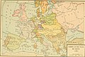
English: Maps showing the year 1802 (i.e. history maps)
See also category: 1802 maps. and 1800s maps for more maps showing this year usually created not long after the given year.
See also category: 1802 maps. and 1800s maps for more maps showing this year usually created not long after the given year.
Subcategories
This category has only the following subcategory.
Media in category "Maps showing 1802"
The following 4 files are in this category, out of 4 total.
-
 Karte ErzbistumKoeln.png 2,713 × 2,391; 643 KB
-
-
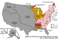 United States 1800-07-10-1802.png 1,000 × 677; 102 KB
-
 United States 1802-1803-03.png 1,000 × 677; 100 KB

_(14777961651).jpg)

