Category:Maps showing 1430
Jump to navigation
Jump to search
| 1430 1434 1435 1436 |
English: Maps showing the year 1430 (i.e. history maps)
See also category: 1430 maps. and 1430s maps for more maps showing this year usually created not long after the given year.
See also category: 1430 maps. and 1430s maps for more maps showing this year usually created not long after the given year.
Media in category "Maps showing 1430"
The following 9 files are in this category, out of 9 total.
-
1430 m. LDK administracinis susiskirstymas.svg 1,031 × 1,044; 353 KB
-
Carte du royaume de France pendant la mission de Jeanne d'Arc 1429-1430.jpg 6,900 × 6,935; 19.52 MB
-
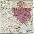
Grand Duchy of Lithuania 1430.png 2,013 × 1,724; 263 KB
-
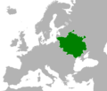
Lithuania Territorial Extension 1430.svg 735 × 333; 534 KB
-
Princedom of simsim.jpg 903 × 591; 277 KB


