Category:Maps showing 1360
Jump to navigation
Jump to search
| 1360 → |
English: Maps showing the year 1360 (i.e. history maps)
See also category: 1360 maps. and 1360s maps for more maps showing this year usually created not long after the given year.
See also category: 1360 maps. and 1360s maps for more maps showing this year usually created not long after the given year.
Media in category "Maps showing 1360"
The following 17 files are in this category, out of 17 total.
-
C. 1360 Europe and Western Asia.jpg 2,112 × 1,365; 2.11 MB
-
C. 1360 Europe.jpg 4,045 × 3,000; 3.9 MB
-
C. 1360 France and Holy Roman Empire.jpg 1,890 × 1,276; 1.52 MB
-
France after the Peace of Brétigny 1360 (Johnston).jpg 1,120 × 1,159; 783 KB
-
Angevin Europe 1360.jpg 649 × 498; 170 KB
-
Byz Empire Osman Trebizond 1360.png 552 × 392; 93 KB
-
C. 1360 Eastern Europe.jpg 1,491 × 1,284; 1.41 MB
-
C. 1360 Southeastern Europe.jpg 1,836 × 1,217; 1.24 MB
-
C. 1360 Southwestern Europe.jpg 1,469 × 1,248; 1.59 MB
-
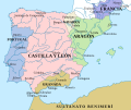
CastillaLeon 1360-es.svg 1,696 × 1,426; 913 KB
-
CastillaLeon 1360-fr.svg 1,927 × 1,426; 406 KB
-
CastillaLeon 1360-pt.svg 1,696 × 1,426; 1.04 MB
-
CastillaLeon 1360.png 614 × 552; 702 KB
-
English Possessions in France, 1180-1429.png 563 × 877; 1.28 MB
-
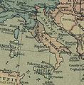
Napels1360.jpg 333 × 339; 41 KB
-
МК1360.jpg 672 × 462; 86 KB


