Category:Maps of wildfires in the United States
Jump to navigation
Jump to search
| NO WIKIDATA ID FOUND! Search for Maps of wildfires in the United States on Wikidata | |
| Upload media |
Media in category "Maps of wildfires in the United States"
The following 56 files are in this category, out of 56 total.
-
1918 Cloquet fire map.webp 1,000 × 654; 129 KB
-
1961 Harlow Fire.png 4,250 × 5,500; 28.02 MB
-
2002 Curve Fire map.png 4,250 × 5,500; 29.01 MB
-
2002 Curve Fire Post-Fire Conditions.jpg 704 × 544; 409 KB
-
2002 Wolf Fire map.png 4,250 × 5,500; 29.03 MB
-
20061011 final perimeter Day 8x11L.pdf 1,639 × 1,066; 400 KB
-
2008 Telegraph Fire map.png 4,250 × 5,500; 26.95 MB
-
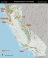
2012 California wildfires map.png 5,000 × 6,000; 27.88 MB
-
2012 Reading Fire map 1.png 4,250 × 5,500; 21.06 MB
-
2013 California wildfires map.png 5,000 × 6,000; 27.84 MB
-
2013 Rim Fire map 1.png 4,250 × 5,500; 32.43 MB
-
2014 California wildfires map.png 5,000 × 6,000; 27.79 MB
-
2015 California wildfires map.png 5,000 × 6,000; 27.82 MB
-
2015 Rocky Fire map.png 4,250 × 5,500; 28.27 MB
-
2016 California wildfires map.png 5,000 × 6,000; 27.88 MB
-
2017 California wildfires map.png 5,000 × 6,000; 27.84 MB
-
2017 Nuns Fire map 1.png 3,000 × 2,500; 12.36 MB
-
2018 California wildfires map.png 5,000 × 6,000; 27.88 MB
-
2019 California wildfires map.png 5,000 × 6,000; 27.86 MB
-
2020 Apple Fire map.png 2,500 × 2,500; 9.95 MB
-
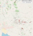
2020 Arizona wildfires map.png 4,344 × 4,712; 8.67 MB
-
2020 California wildfires map.png 5,000 × 6,000; 27.89 MB
-
2020 Creek Fire map.gif 1,200 × 1,200; 526 KB
-
2020 Creek Fire map.png 1,200 × 1,200; 2.89 MB
-
2020 North Complex Fire map 1.png 4,250 × 5,500; 31.36 MB
-
2021 Caldor Fire map.gif 1,750 × 1,200; 694 KB
-
2021 Caldor Fire map.png 1,750 × 1,200; 4.03 MB
-
2021 California wildfires map.png 5,000 × 6,000; 27.7 MB
-
2021 Dixie Fire map 1.png 3,100 × 2,500; 11.62 MB
-
2021 Fawn Fire map.png 4,250 × 5,500; 23.79 MB
-
2021 River Fire map.jpg 3,658 × 2,712; 4.01 MB
-
2022 California wildfires map.png 5,000 × 6,000; 27.8 MB
-
2022 Fairview Fire map.png 3,500 × 2,500; 12.67 MB
-
2022 Mosquito Fire map 1.png 4,250 × 5,500; 29.84 MB
-
2022 Oak Fire map 1.png 4,250 × 5,500; 26.91 MB
-
2023 California wildfires map.png 5,000 × 6,000; 27.79 MB
-
2024 Line Fire map.png 4,250 × 5,500; 27.09 MB
-
49er map 1.png 4,250 × 5,500; 23.46 MB
-
Bond Fire map.png 804 × 594; 823 KB
-
Creek Fire progression map, October 26, 2020.png 7,200 × 9,600; 78.87 MB
-
ErskineFireBriefingMap.jpg 3,300 × 2,550; 1.4 MB
-
Forest-service-map of the spread of the Pagami Creek Fire.jpg 504 × 327; 91 KB
-
Greenwood Fire PIO Map August 24th 2021.pdf 1,650 × 1,275; 1.35 MB
-
Kendrick Wildfire (26803220148).jpg 1,275 × 1,545; 597 KB
-
LaBreaFire.jpeg 1,280 × 853; 250 KB
-
Locations-of-Great-Fires-of-1871.svg 2,289 × 1,744; 340 KB
-
Mann Gulch Fire, 1949. Dodge "escape fire" map.jpg 2,113 × 1,690; 329 KB
-
Mann Gulch Fire, map of events, 5 August 1949.png 616 × 458; 156 KB
-
Milford Flat Fire perimeter.pdf 1,650 × 2,550; 4.31 MB
-
MountainViewFireMap.jpg 3,360 × 2,520; 736 KB
-
NIFC August 2018 fire potential outlook - 20180501.png 3,300 × 2,550; 473 KB
-
Pagami Creek Fire severity map USFS.png 729 × 421; 440 KB
-
Pagamicreekfire-map-1024x624.png 1,024 × 624; 425 KB
-
River Fire map 2.png 4,250 × 5,500; 23.86 MB
-
WildfiresUS.pdf 1,650 × 1,275; 5.34 MB
-
Wildland Fire in Ecosystems 15-1-2.png 1,804 × 1,396; 1.43 MB


