Category:Maps of weather and climate of Italy
Jump to navigation
Jump to search
Subcategories
This category has the following 11 subcategories, out of 11 total.
Media in category "Maps of weather and climate of Italy"
The following 26 files are in this category, out of 26 total.
-
2024 Climate Index in Italy.jpg 1,414 × 1,670; 413 KB
-
Carta corretta dell'eliofania media annua in Italia.jpg 1,284 × 1,423; 147 KB
-
Carta della Temperatura media in Italia.jpg 3,461 × 3,467; 1.15 MB
-
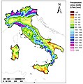
Carta delle precipitazioni medie in Italia.jpg 3,444 × 3,483; 1.28 MB
-
Carte delle temperature medie in Italia nel primo semestre dell'anno.jpg 2,765 × 4,096; 1.54 MB
-
Carte delle temperature medie in Italia nel secondo semestre dell'anno.jpg 2,761 × 4,096; 1.52 MB
-
Extreme temperature in Italy.jpg 1,414 × 1,421; 342 KB
-
Italia carta rusticità.png 466 × 521; 9 KB
-
Map Climate 1989 - Touring Club Italiano CART-TEM-014.jpg 5,000 × 3,387; 9.47 MB
-
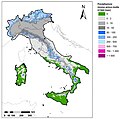
Map Precipitation 1989 - Touring Club Italiano CART-TEM-012.jpg 5,000 × 3,344; 9.52 MB
-
Map Water balance 1989 - Touring Club Italiano CART-TEM-013.jpg 5,000 × 3,273; 3.1 MB
-
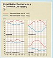
Map Wind 1989 - Annual wind roses - Touring Club Italiano CART-TEM-011 (cropped).jpg 2,241 × 2,990; 5.06 MB
-
Map Wind 1989 - Touring Club Italiano CART-TEM-011.jpg 5,000 × 3,304; 9.33 MB
-
Meteo1.png 541 × 470; 111 KB
-
Stazioni meteo AM-ENAV Toscana.PNG 378 × 402; 10 KB
-
Temperature estreme in Italia.jpg 1,414 × 1,407; 286 KB


