Category:Maps of volcanoes in Haute-Loire
Jump to navigation
Jump to search
Subcategories
This category has the following 5 subcategories, out of 5 total.
B
- Maps of Lac du Bouchet (2 F)
M
- Maps of Mont Mézenc (4 F)
Media in category "Maps of volcanoes in Haute-Loire"
The following 6 files are in this category, out of 6 total.
-
Desmarest-1827--atlas du dictionnaire de geographie physique--pl.45-volcans 2e epoque.png 1,608 × 1,112; 2.24 MB
-
Lac de Saint-Front (Haute-Loire) OSM.png 726 × 666; 215 KB
-
Le Puy-en-Velay OSM 02.png 483 × 579; 373 KB
-
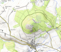
Mont d'Alambre OSM.png 682 × 587; 324 KB
-
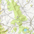
Mont Devès OSM.png 639 × 651; 402 KB
-
Mont Mézenc OSM.png 386 × 318; 163 KB


