Category:Maps of vilayets of the Ottoman Empire
Jump to navigation
Jump to search
Subcategories
This category has the following 3 subcategories, out of 3 total.
Media in category "Maps of vilayets of the Ottoman Empire"
The following 44 files are in this category, out of 44 total.
-
CUINET(1892) 2.294 Deir ez-Zor Vilayet.jpg 3,438 × 2,971; 4.29 MB
-
CUINET(1894) 3.348 Smyrne Vilayet.jpg 3,445 × 3,045; 6.03 MB
-
CUINET(1894) 3.704 Mutessariflik Bigha.jpg 3,431 × 2,769; 6.41 MB
-
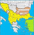
Balkan vilayets.jpg 755 × 769; 167 KB
-
Bosnia Vilayet — Memalik-i Mahruse-i Shahane-ye Mahsus Mukemmel ve Mufassal Atlas (1907).jpg 3,964 × 4,615; 7.99 MB
-
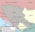
Bosnia1878.svg 662 × 684; 475 KB
-
Bosnie et Sandjak 1904 ES.svg 2,005 × 2,066; 344 KB
-
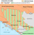
Bosnie et Sandjak 1904 hu.png 800 × 824; 166 KB
-
Bosnie et Sandjak 1904 mk.svg 2,000 × 1,826; 132 KB
-
Bosnie et Sandjak 1904.svg 2,000 × 1,826; 139 KB
-
Bosznia és Szandzsák 1904.svg 2,000 × 1,826; 139 KB
-
Brockhaus and Efron Encyclopedic Dictionary b2 955-3.jpg 3,339 × 2,552; 4.66 MB
-
Croatian Military Frontier-1868.png 387 × 294; 20 KB
-
Danube Vilayet with Sanjak Borders.png 854 × 469; 273 KB
-
Djezire-Isl.jpg 629 × 465; 84 KB
-
Kosovo02-sr.png 770 × 845; 66 KB
-
Kosovo02.png 770 × 845; 76 KB
-
Kosovo03-sr.png 820 × 762; 65 KB
-
Vilayet of Kosovo (1881–1912) map.png 820 × 762; 74 KB
-
Irak Vilayets.PNG 347 × 422; 14 KB
-
Kingdom of Dalmatia-1868.png 542 × 502; 35 KB
-
Kosovo Vilayet 1905.jpg 600 × 444; 166 KB
-
Kosovo Vilayet — Memalik-i Mahruse-i Shahane-ye Mahsus Mukemmel ve Mufassal Atlas (1907).jpg 2,133 × 1,653; 1.89 MB
-
Map of the Kingdom of Croatia (1868).png 542 × 502; 40 KB
-
Map of the Kingdom of Croatia-Slavonia (1885).png 542 × 502; 31 KB
-
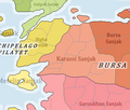
Ottoman Empire Administrative Divisions, Karassi Sanjak.png 435 × 371; 33 KB
-
Ottoman Empire Administrative Divisions-es.svg 1,725 × 1,868; 5.5 MB
-
Ottoman Empire Administrative Divisions-tr.png 3,549 × 3,845; 3.16 MB
-
Ottoman Empire Administrative Divisions-tr.svg 1,725 × 1,868; 2.19 MB
-
Ottoman Empire Administrative Divisions.png 4,455 × 4,840; 2.1 MB
-
Trabzon Vilayeti haritası.png 2,651 × 1,773; 5.69 MB
-
Vilaet Bitolya.jpg 685 × 990; 229 KB
-
Vilaet Solunski.jpg 750 × 531; 85 KB
-
Vilayet of Aydın (1881) Boundaries and Ethnic Makeup.png 4,153 × 3,761; 59.7 MB
-
Vilayet of Selanik (1881) Boundaries and Ethnic Makeup.png 5,308 × 3,604; 73.11 MB
-
Vilayet of the Archipelago (1881) Boundaries and Ethnic Makeup.png 7,088 × 6,898; 186.83 MB
-
Vilayets of the Ottoman Empire (blank, 1900).svg 2,409 × 1,488; 116 KB
-
Yanina Vilaet Map.jpg 750 × 1,099; 184 KB


