Category:Maps of the province of Turin
Jump to navigation
Jump to search
Subcategories
This category has the following 3 subcategories, out of 3 total.
Media in category "Maps of the province of Turin"
The following 22 files are in this category, out of 22 total.
-
Torino location map blank.PNG 689 × 772; 28 KB
-
Torino location map winter olympics.PNG 687 × 768; 34 KB
-
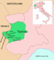
Torino posizione.png 350 × 424; 14 KB
-
'ndrangheta in provincia di Torino 2017.jpg 1,098 × 739; 139 KB
-
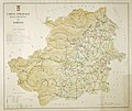
Carta stradale di Torino. (provincia).jpg 3,918 × 3,286; 10.64 MB
-
Circondario di Aosta.png 1,043 × 1,200; 231 KB
-
Circondario di Ivrea.png 1,043 × 1,200; 231 KB
-
Circondario di Pinerolo.png 1,043 × 1,200; 231 KB
-
Circondario di Susa.png 1,043 × 1,200; 231 KB
-
Circondario di Torino.png 1,043 × 1,200; 231 KB
-
Evolucion del territòri d'Ors.svg 413 × 113; 13 KB
-
Map - IT - Torino - Comunità Montana Valli Ceronda e Casternone.svg 800 × 600; 1.33 MB
-
Map of the XX Olympic Winter Games (blank).png 2,000 × 1,600; 134 KB
-
Map of the XX Olympic Winter Games (english).png 2,000 × 1,600; 176 KB
-
Map of the XX Olympic Winter Games (french).png 2,000 × 1,600; 176 KB
-
Map of the XX Olympic Winter Games (italian).png 2,000 × 1,600; 176 KB
-
Regno di Sardegna provincia di Torino 1859.svg 637 × 1,267; 184 KB
-
Stielers Handatlas 1891 22.jpg 5,050 × 4,300; 6.56 MB
-
Torino in Italy.svg 1,034 × 1,299; 3 MB
-
Torino mappa.png 750 × 644; 263 KB


