Category:Maps of the kingdom of Württemberg
Jump to navigation
Jump to search
Media in category "Maps of the kingdom of Württemberg"
The following 13 files are in this category, out of 13 total.
-
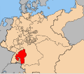
Wurttemberg in the German Reich (1871).svg 1,425 × 1,133; 1,014 KB
-
Map-DB-Württemberg.svg 1,793 × 1,571; 1.67 MB
-
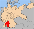
Deutsches Reich (Karte) Württemberg.svg 650 × 545; 1.04 MB
-
KgrWuerttemberg.png 1,524 × 1,968; 120 KB
-
Kingdom of Württemberg (1812).svg 450 × 456; 611 KB
-
Kingdom of Württemberg 1815.svg 450 × 456; 812 KB
-
KRWuerttemberg.png 1,741 × 1,444; 66 KB
-
Map-DR-Wuerttemberg.svg 2,621 × 2,224; 712 KB
-
Standorte württembergischer Bürgerwehren.jpg 481 × 601; 62 KB
-
Wuerttemberg.svg 498 × 690; 351 KB
-
Wurttemberg in the German Reich (1925).svg 1,425 × 1,133; 967 KB
-
Map-WR-Wuerttemberg.svg 1,185 × 1,007; 541 KB


