Category:Maps of the indigenous peoples of South America
Jump to navigation
Jump to search
Subcategories
This category has the following 11 subcategories, out of 11 total.
*
B
C
P
V
Media in category "Maps of the indigenous peoples of South America"
The following 12 files are in this category, out of 12 total.
-
Amerindians and Inuits map.png 5,048 × 5,300; 1.72 MB
-
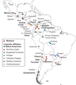
Approximate Geographic Location of the Mestizo and Native American Populations.png 3,487 × 3,879; 1.59 MB
-
Arawaks Aujourd'hui.jpg 1,111 × 793; 108 KB
-
Gediindig gedi 2021 lrg.jpg 2,913 × 1,942; 2.67 MB
-
Gediindig gedi 2021.jpg 720 × 545; 497 KB
-
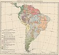
Map Ethnographic map of South America 1928-1940 - Touring Club Italiano CART-TRC-31.jpg 7,302 × 6,736; 21.52 MB
-
People kolla.png 2,808 × 4,176; 131 KB
-
Povos pré-colombianos no Brasil.jpg 1,888 × 2,445; 617 KB
-
The American Indian Fig 87.jpg 1,600 × 2,174; 256 KB


