Category:Maps of the history of the canton of Vaud
Jump to navigation
Jump to search
Cantons of Switzerland: Bern (BE) · Fribourg (FR) · Geneva (GE) · Graubünden (GR) · Valais (VS) · Vaud (VD) · Zürich (ZH)
Use the appropriate category for maps showing all or a large part of canton Vaud. See subcategories for smaller areas:
| If the map shows | Category to use |
|---|---|
| canton Vaud on a recently created map | Category:Maps of Canton of Vaud or its subcategories |
| canton Vaud on a map created more than 70 years ago | Category:Old maps of Canton of Vaud or its subcategories |
| the history of canton Vaud on a recently created map | Category:Maps of the history of Canton of Vaud or its subcategories |
| the history of canton Vaud on a map created more than 70 years ago | Category:Old maps of the history of Canton of Vaud or its subcategories |
Media in category "Maps of the history of the canton of Vaud"
The following 34 files are in this category, out of 34 total.
-
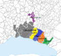
Bailliage Lausanne.png 491 × 449; 134 KB
-
Bailliage Vevey.png 764 × 704; 108 KB
-
Bailliage Yverdon 1536-1566.png 1,996 × 1,588; 730 KB
-
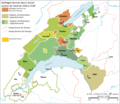
Bailliages bernois Vaud 1536-1539.png 2,897 × 2,518; 2.05 MB
-
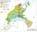
Bailliages bernois Vaud 1539-1555.png 2,897 × 2,518; 2.08 MB
-
Berner-Vogteien-im-Kanton-Waadt fr.png 2,000 × 1,867; 454 KB
-
Bernische-Vogteien-Kanton-Waadt.png 2,897 × 2,518; 1.63 MB
-
Burgunderkriege.png 2,500 × 2,527; 1.13 MB
-
Carte du gouvernement d’Aigle 1788.jpeg 400 × 323; 31 KB
-
Droysens-25d.jpg 2,626 × 1,390; 3.89 MB
-
Extrait Tablede Peutinger Secteur Rhône et Alpes.jpg 896 × 356; 196 KB
-
Gouvernement Aigle.png 648 × 496; 125 KB
-
Gouvernement de Hautcrêt.png 315 × 319; 61 KB
-
Karte Bernische-Vogteien-Kanton-Waadt en.png 2,000 × 1,738; 477 KB
-
Karte Bernische-Vogteien-Kanton-Waadt fr.png 2,000 × 1,738; 505 KB
-
Karte Distrikte Kanton Leman-DE.png 2,000 × 1,896; 400 KB
-
Karte Distrikte Kanton Leman.png 2,000 × 1,896; 400 KB
-
Karte Stadtstaat Bern vereinfacht-EN.png 2,000 × 1,655; 615 KB
-
Karte Stadtstaat Bern vereinfacht.png 2,000 × 1,655; 604 KB
-
Karte Stadtstaat Bern version-für-svgexport.png 4,000 × 3,401; 1.25 MB
-
Karte Stadtstaat Bern Wachstum.png 2,500 × 2,060; 957 KB
-
Karte-Entwicklung-Savoyen-bis-1789.png 2,500 × 2,542; 1.05 MB
-
Karte-Herzogtum-Savoyen-1475.png 1,500 × 1,551; 583 KB
-
Oron et Corsier.png 315 × 319; 62 KB
-
Partage La Sarraz 1624.png 2,952 × 2,940; 1.32 MB
-
Possessions des Blonay en Suisse.png 1,224 × 970; 487 KB
-
Possessions des Oron.png 750 × 652; 227 KB
-
Rovéréa Grouner Carte du gouvernement d’Aigle.jpg 298 × 267; 53 KB
-
Saint-martin du chêne 1200.png 728 × 576; 142 KB
-
Saint-martin du chêne 1400.png 728 × 576; 143 KB
-
Saint-martin-du-chene 1600.png 728 × 576; 145 KB
-
Seigneurie de La Sarraz après 1344.png 2,952 × 2,940; 1.33 MB
-
Seigneurie de La Sarraz.png 2,952 × 2,940; 1.33 MB


