Category:Maps of the history of the Ottoman Empire in the 1450s
Jump to navigation
Jump to search
Maps of the history of the Ottoman Empire by decade: ◀ · 1400s · 1410s · 1420s · 1430s · 1440s · 1450s · 1460s · 1470s · 1480s · 1490s · ▶
Media in category "Maps of the history of the Ottoman Empire in the 1450s"
The following 28 files are in this category, out of 28 total.
-
 A Short History of the World, p0294.jpg 1,178 × 894; 286 KB
-
 Bütsants1450.png 2,530 × 2,396; 536 KB
-
 Eastern Mediterranean 1450 - Arabic.PNG 2,690 × 2,395; 636 KB
-
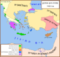 Eastern Mediterranean 1450 - HE.svg 2,529 × 2,395; 259 KB
-
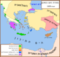 Eastern Mediterranean 1450 -HE.svg 2,529 × 2,395; 319 KB
-
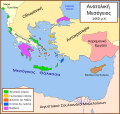 Eastern Mediterranean 1450 el.svg 2,529 × 2,395; 226 KB
-
 Eastern Mediterranean 1450 es.svg 2,529 × 2,395; 362 KB
-
 Eastern Mediterranean 1450 hu.png 945 × 900; 322 KB
-
 Eastern Mediterranean 1450 pt.svg 512 × 485; 92 KB
-
 Eastern Mediterranean 1450 tr.png 2,529 × 2,395; 624 KB
-
 Eastern Mediterranean 1450- sr lat.svg 2,529 × 2,395; 453 KB
-
 Eastern Mediterranean 1450-hu.svg 2,497 × 2,369; 180 KB
-
 Eastern Mediterranean 1450-ru.svg 2,497 × 2,369; 267 KB
-
 Eastern Mediterranean 1450-sr.svg 2,529 × 2,395; 223 KB
-
 Eastern Mediterranean 1450-zh.svg 3,121 × 2,962; 219 KB
-
 Eastern Mediterranean 1450.svg 2,497 × 2,369; 265 KB
-
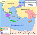 Eastern Mediterranean in 1450-hy.png 2,163 × 2,048; 329 KB
-
 Empire-byzantin-1450.svg 1,913 × 1,169; 1.51 MB
-
 Hunyadi terkep.png 1,252 × 906; 700 KB
-
 Mediterraneo Orientale 1450.svg 2,449 × 2,320; 546 KB
-
 Mediterráneo Oriental 1450 d.C.svg 2,529 × 2,395; 307 KB
-
 Mediteràneo Orientàl 1450 - lmo.svg 2,529 × 2,395; 280 KB
-
 MéditerranéeOrient1450.PNG 633 × 599; 91 KB
-
 OttomanEmpire1451-ar.png 3,598 × 2,584; 1.01 MB
-
 OttomanEmpire1451.png 3,598 × 2,584; 969 KB
-
 Se Easterna Wendelsæ in 1450.svg 2,529 × 2,395; 278 KB
-
 The Ottoman Empire before 1453, H. G. Wells' Outline of History, page 366.jpg 1,572 × 1,216; 392 KB
-
 Östliches Mittelmeer 1450 DE.svg 2,529 × 2,395; 201 KB


