Category:Maps of the history of the Iberian Peninsula
Jump to navigation
Jump to search
Subcategories
This category has the following 10 subcategories, out of 10 total.
*
B
C
- Maps of the Couto Misto (14 F)
M
P
- Maps of Pre-Roman Iberia (115 F)
- Maps of Prehistoric Iberia (13 F)
R
Media in category "Maps of the history of the Iberian Peninsula"
The following 20 files are in this category, out of 20 total.
-
Arquitectura castreña.jpg 940 × 676; 211 KB
-
ATLAS JUSTUS PERTHES 01.jpg 4,604 × 3,909; 9.16 MB
-
Conquista Hispania.svg 950 × 650; 1.07 MB
-
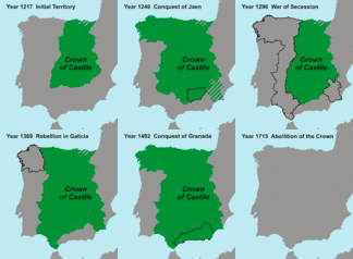
Crown of Castile - Map-ar.gif 330 × 365; 354 KB
-
Crown of Castile - Map.gif 330 × 365; 287 KB
-
Hispania 1a division provincial.PNG 511 × 358; 12 KB
-
Hispania 2a division provincial.PNG 511 × 357; 6 KB
-
Hispania 3a division provincial.PNG 506 × 357; 10 KB
-
Hispania maxima AD.svg 2,344 × 2,344; 171 KB
-
Hispania maximo AD.PNG 2,500 × 2,500; 321 KB
-
Hispania roads.svg 707 × 559; 80 KB
-
Iberia 210-206BC-it.png 940 × 850; 301 KB
-
Iberia 211-210BC-it (cropped).png 439 × 321; 73 KB
-
Iberia 211-210BC-it.png 940 × 850; 295 KB
-
Iberia 218-211BC-it.png 940 × 850; 310 KB
-
Iberic peninsula c. 156 BC.png 310 × 256; 55 KB
-
Iberos.png 788 × 648; 773 KB
-
Spruner-Menke Handatlas 1880 Karte 18.jpg 10,177 × 8,513; 21.68 MB
-
TartessosES.jpg 4,000 × 2,320; 1.37 MB


