Category:Maps of the history of coastlines in Asia
Jump to navigation
Jump to search
Media in category "Maps of the history of coastlines in Asia"
The following 12 files are in this category, out of 12 total.
-
Ephese regional carte.png 280 × 199; 112 KB
-
Ephesos regional map.svg 1,170 × 832; 1.91 MB
-
Ephesos silting.gif 620 × 339; 158 KB
-
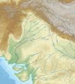
Ghaggar-Hakra ancient river bed.svg 1,887 × 2,084; 7.16 MB
-
HuangHeZmenyDolnihoToku.PNG 665 × 440; 33 KB
-
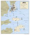
MapaMacau1986.jpg 1,048 × 1,234; 160 KB
-
Miletus Bay silting evolution map-en.svg 1,857 × 1,349; 1.54 MB
-
Miletus Bay silting evolution map-es.svg 1,857 × 1,349; 1.45 MB
-
Miletus Bay silting evolution map-fr.svg 1,857 × 1,349; 1.55 MB
-
Miletus Bay silting evolution map-ru.svg 1,857 × 1,349; 1.55 MB
-
Paleogeographic maps east Asia. Turgai Sea.jpg 900 × 1,649; 100 KB
-
Sarasvati-ancient-river.jpg 970 × 1,204; 262 KB


