Category:Maps of the history of Sindh
Jump to navigation
Jump to search
Media in category "Maps of the history of Sindh"
The following 16 files are in this category, out of 16 total.
-
Administrative Map of Sindh 1608~1700 A.D.jpg 2,320 × 3,040; 584 KB
-
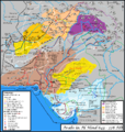
Arabsum5.png 1,000 × 1,066; 294 KB
-
Arabsumf.png 1,000 × 1,056; 319 KB
-
Arabsumf1.png 1,000 × 1,056; 335 KB
-
Islamic Campaign to Sindh in 39 H.png 1,241 × 819; 1.5 MB
-
Map of the Habbarid and Multan Emirates.png 2,324 × 2,151; 6.49 MB
-
Mohammad adil rais-battle of rasil.PNG 936 × 486; 50 KB
-
QASIM-ar.png 459 × 400; 111 KB
-
QASIM.PNG 459 × 400; 87 KB
-
Rai Dynasty of Sindh under Rai Shasi II The Last.png 5,699 × 6,885; 4.37 MB
-
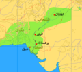
Sindh 700ad-ar.png 720 × 473; 685 KB
-
Sindh 700ad.jpg 720 × 473; 432 KB
-
Sindh and Kutch 1827 map.jpg 3,145 × 4,129; 2.38 MB
-
Sindh Kalhora Dynasty Map.png 1,063 × 933; 56 KB
-
The Budhist Kingdom of Sindh 642 A.D.jpg 2,309 × 3,344; 689 KB
-
فتوح قتيبة بن مسلم ومحمد بن القاسم.jpg 669 × 975; 234 KB


