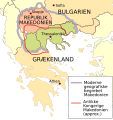
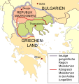
Category:Maps of the history of Macedonia
Jump to navigation
Jump to search
Subcategories
This category has only the following subcategory.
A
Media in category "Maps of the history of Macedonia"
The following 52 files are in this category, out of 52 total.
-
C. 1210 Southeastern Europe and Asia Minor.jpg 4,000 × 3,000; 2.92 MB
-
Ancient Macedonia within Greece (el).png 1,876 × 1,749; 455 KB
-
Borders of Macedonia according authors (1843-1927).png 4,590 × 2,636; 1.71 MB
-
Bulgaria of Kuber.gif 865 × 828; 237 KB
-
Bulgaria under Ivan Asen II.jpg 2,160 × 3,840; 1.39 MB
-
Bulgaria-Ivan Asen 3.png 1,982 × 2,113; 1.13 MB
-
Bulgaria-Iván Asen-es.svg 1,122 × 1,176; 3.24 MB
-
Bulgaria-Iván Asen2-es.svg 1,197 × 1,052; 2.82 MB
-
Bulgarian-Vlach empire since primary sources.png 1,688 × 1,372; 955 KB
-
Campaigns of tsar Ivan Assen II.jpg 2,156 × 2,297; 1.38 MB
-
Campaigns of tsar Ivan Assen IIOriginal-es.svg 1,122 × 1,198; 3.7 MB
-
Carte ethnographique de la Macédoine du Sud 1912.jpg 5,000 × 2,048; 7.46 MB
-
Czepyn.png 800 × 545; 796 KB
-
Distribution Of Races 1918 National Geographic.jpg 2,267 × 1,214; 1.1 MB
-
Ethnicmacedonia.jpg 889 × 725; 299 KB
-
Ethnographic Map of Macedonia, 1899.jpg 1,754 × 1,357; 905 KB
-
Ethnographic map of the central Balkans, ca. 1900.png 1,720 × 1,859; 6.42 MB
-
First Balkan war - liberated territories 1913.png 1,204 × 1,191; 666 KB
-
Grèce 1ere Guerre balkanique.png 1,754 × 1,525; 807 KB
-
HistMac.gif 326 × 326; 882 KB
-
HistMacSrb.gif 726 × 726; 2.54 MB
-
Limba macedoneana.jpg 668 × 589; 107 KB
-
LocationMacedonia-OTT-2-z.png 500 × 400; 12 KB
-
MacedonEmpire-he.png 2,000 × 961; 3.01 MB
-
Macedonia (disambiguation 2).png 286 × 332; 21 KB
-
Macedonia (disambiguation).png 286 × 332; 12 KB
-
Macedonia (region) borders - mk.png 1,006 × 744; 58 KB
-
Macedonia disambiguation map.svg 556 × 589; 294 KB
-
Macedonia historic maps.gif 180 × 180; 112 KB
-
Macedonia overview (hy).png 551 × 627; 76 KB
-
Macedonia overview da.svg 556 × 589; 544 KB
-
Macedonia overview de.svg 556 × 589; 638 KB
-
Macedonia overview-es.svg 556 × 589; 551 KB
-
Macedonia(distribution).png 281 × 330; 23 KB
-
Macedonia-borders 1878-1914 lgnd.png 3,147 × 3,081; 1.17 MB
-
Macedonia-borders 1878-1914.png 1,007 × 736; 59 KB
-
Macedonia-borders 1914-1999.png 1,006 × 1,037; 71 KB
-
Macedonia-disambiguation.svg 425 × 496; 135 KB
-
Macedonian Slavic dialects 2.png 620 × 455; 131 KB
-
Maximal Greek claims in Epirus and Macedonia.png 300 × 318; 31 KB
-
Mk 1952 opstini.gif 1,014 × 814; 29 KB
-
Rival territorial claims after the First Balkan War.png 1,500 × 1,179; 448 KB
-
RizMap10.jpg 1,569 × 1,605; 879 KB
-
Samuels Macedonian Kingdom.jpg 1,375 × 1,264; 1.83 MB
-
The Balkan boundaries after 1913.jpg 646 × 852; 223 KB
-
The Contested Zone Defined in 1912 & Serbia's Claim to the Uncontested Zone in 1913.png 5,155 × 3,699; 4.92 MB
-
Triple occupation of Macedonia, Greece.png 1,108 × 808; 137 KB
-
Vilayets in the region of Macedonia 1907.png 1,042 × 912; 82 KB
-
Административна карта на Македонија, почеток на ХХ век.pdf 1,260 × 987; 8.85 MB
-
Востанието на Петар Делјан (територијална карта).jpg 421 × 671; 92 KB


