Category:Maps of the history of Brabant
Jump to navigation
Jump to search
Media in category "Maps of the history of Brabant"
The following 29 files are in this category, out of 29 total.
-
Gelre1477.png 772 × 673; 937 KB
-
Brabant in the world.png 742 × 838; 60 KB
-
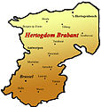
Brabant map.png 402 × 599; 30 KB
-
Brabant primitif.jpg 744 × 442; 64 KB
-
Brabant1477.png 409 × 362; 331 KB
-
County of Hoorne.png 332 × 318; 214 KB
-
County of Soissons (1180).png 427 × 398; 107 KB
-
Duchy of Brabant and Duchy of Guelders (1350) locator map.svg 2,813 × 3,602; 384 KB
-
Eersel 10046. At-mF (84x60 6 MB) 2023-06-03.jpg 4,763 × 3,402; 5.75 MB
-
Eersel 10046. At-mF 420x300 27,7 MB) 2023-06-07.jpg 11,907 × 8,505; 26.42 MB
-
Grafschaft Hennegau 1250.PNG 745 × 479; 265 KB
-
Kaartbrabant.jpg 380 × 400; 31 KB
-
Locator Duchy of Brabant (1350).svg 2,818 × 3,608; 427 KB
-
Locator Duchy of Brabant and Limburg (1350).svg 2,818 × 3,608; 427 KB
-
Low Countries Locator Brabant Limburg and Overmaas.svg 1,550 × 2,000; 212 KB
-
Low Countries Locator Brabant.svg 1,550 × 2,000; 381 KB
-
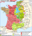
Map France 1180-br.svg 988 × 1,124; 1.9 MB
-
Map France 1180-de.svg 988 × 1,124; 1.94 MB
-
Map France 1180-es.svg 988 × 1,124; 1.97 MB
-
Map France 1180-fr.svg 988 × 1,124; 1.88 MB
-
Map France 1180-ru.svg 988 × 1,124; 1.88 MB
-
Map France 1180-uk.svg 988 × 1,124; 1.68 MB
-
VGhK.014N F1-F5 Witreit-Weibosch, Postelse Heide 16,2 MB 2023-10-23.jpg 6,804 × 9,526; 15.4 MB
-
VGhK.014N Witreit-Weibosch 19,6 MB 2023-10-23.jpg 9,526 × 6,804; 18.71 MB
-
VGhK.F1-F2 Bergeijk Witreit Weebosch (50-75 23,4MB 2023-11-19)jpg.jpg 9,668 × 6,906; 22.3 MB
-
VGK.014N F1-F5 Witreit-Weibosch, Postelse Heide 16,8 MB 2023-10-23.jpg 6,804 × 9,526; 16.03 MB
-
VGK.014N Witreit-Weibosch 20,8 MB 2023-10-23.jpg 9,526 × 6,804; 19.82 MB
-
War of the Brabantian Succession (1355–1357) locator map.svg 2,813 × 3,602; 388 KB

