Category:Maps of the border between Costa Rica and Nicaragua
Jump to navigation
Jump to search
Media in category "Maps of the border between Costa Rica and Nicaragua"
The following 15 files are in this category, out of 15 total.
-
 Mapa del Rio San Juan (1851).jpg 5,651 × 2,323; 5.27 MB
-
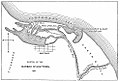
 1919 News coverage of Costa Rica mobilizes her troops on Nicaraguan border.png 1,636 × 1,743; 3.34 MB
-
 Alexander Commission Map 1898.jpg 768 × 1,024; 125 KB
-
 Alexander97.jpg 986 × 672; 192 KB
-
 CañasJerez.jpg 564 × 399; 24 KB
-
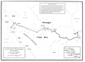 Costa Rica-Nicaragua border.png 1,448 × 1,060; 137 KB
-
 Croquis Laudo Alexander 1.JPG 712 × 475; 50 KB
-
 Croquis Laudo Alexander 2.JPG 539 × 609; 64 KB
-
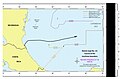 Limites marítimos de Costa Rica en el Mar Caribe.jpg 903 × 591; 72 KB
-
 Mapa de Isla Calero, Costa Rica 2.png 364 × 305; 13 KB
-
 Mapa de Islas Calero, Brava y Portillos, Costa Rica.png 364 × 305; 13 KB
-
 Nicaragua Costa Rica San Juan River border-Spanish-Translate.svg 590 × 450; 230 KB
-
 Nicaragua Costa Rica San Juan River border.svg 590 × 450; 185 KB
-
 Río San Juan de Nicaragua 1851.pdf 1,306 × 493; 574 KB
-
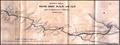
 San Juan River of Nicaragua 1851.jpg 2,608 × 982; 704 KB


.jpg)