Category:Maps of the ancient Peloponnese
Appearance
Subcategories
This category has the following 8 subcategories, out of 8 total.
A
- Maps of ancient Achaea (11 F)
- Maps of the Achaean League (28 F)
- Maps of ancient Arcadia (3 F)
- Maps of ancient Argolis (6 F)
C
E
- Maps of ancient Elis (3 F)
L
- Maps of ancient Laconia (3 F)
M
- Maps of ancient Messenia (3 F)
Media in category "Maps of the ancient Peloponnese"
The following 51 files are in this category, out of 51 total.
-
THIRLWALL(1845) p1.008 SOUTHERN GREECE.jpg 4,019 × 3,351; 5.69 MB
-
Achean league 150aC-it.svg 785 × 509; 6.25 MB
-
Achean league 150aC-pt.svg 785 × 509; 6.25 MB
-
Achean-League 280-146BC.png 1,951 × 1,519; 492 KB
-
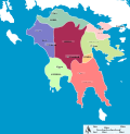
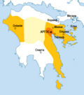
Ancient peloponnese-es.svg 778 × 800; 332 KB
-
Ancient peloponnese-it.svg 778 × 800; 84 KB
-
Ancient peloponnese-pt.svg 778 × 800; 312 KB
-
Ancient peloponnese-zh.svg 972 × 1,000; 92 KB
-
Ancient peloponnese.svg 778 × 800; 87 KB
-
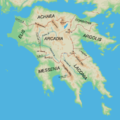
Ancient Regions Peloponnese.png 800 × 800; 289 KB
-
AntiguasRegionesDelPeloponeso.svg 1,292 × 1,507; 15.97 MB
-
Argólida.png 800 × 944; 964 KB
-
Argólida.svg 703 × 780; 16.91 MB
-
Butler Peloponnesus et Græcia Meridionalis.jpg 3,165 × 2,048; 2.09 MB
-
Cleomenes War detail 1 es.svg 1,911 × 2,000; 556 KB
-
Cleomenes War detail 1 pt.svg 343 × 360; 798 KB
-
Cleomenes War detail 1 sr.svg 343 × 360; 796 KB
-
Cleomenes War detail 1-hu.svg 1,911 × 2,000; 419 KB
-
Cleomenes War detail 1-zh.svg 429 × 450; 82 KB
-
Cleomenes War detail 1.svg 343 × 360; 931 KB
-
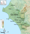
Elide-es.png 650 × 700; 536 KB
-
Elide.png 265 × 500; 19 KB
-
Grecia 194.jpg 536 × 391; 32 KB
-
Karte des Peloponnes nonames.png 651 × 617; 343 KB
-
La Liga aquea en 150 aC-pt.svg 2,201 × 1,280; 214 KB
-
La Liga aquea en 150 aC.jpg 536 × 392; 61 KB
-
La Liga aquea en 150 aC.svg 1,848 × 1,252; 2.79 MB
-
La Liga aquea en 194 aC.svg 1,848 × 1,252; 2.78 MB
-
La-Liga-aquea-He-150-aC.png 536 × 392; 54 KB
-
Megalopolis (Peloponnes).png 1,458 × 1,548; 217 KB
-
Peloponeso del sur.svg 743 × 681; 519 KB
-
Peloponnes and Middle Greece.png 1,772 × 2,028; 332 KB
-
Peloponnes Putzger klein.jpg 1,708 × 1,267; 304 KB
-
Peloponnes text de.png 2,546 × 1,984; 837 KB
-
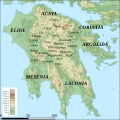
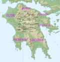
Peloponnese relief map-blank-Arcadia-es.svg 1,236 × 1,233; 14.76 MB
-
Peloponnese relief map-blank-Arcadia.png 1,692 × 1,748; 3.18 MB
-
Peloponnesos.png 675 × 790; 28 KB
-
Pheidon'sEmpire.png 533 × 604; 60 KB
-
RegiónDeÉlide.svg 543 × 1,064; 727 KB
-
SouthernPeloponessus (zh).gif 654 × 599; 134 KB
-
SouthernPeloponessus.gif 743 × 681; 174 KB
-
SouthernPeloponessus.svg 743 × 681; 366 KB
-
Sparta territory.jpg 743 × 681; 201 KB
-
SpartanTerritory.PNG 372 × 394; 29 KB
-
Stymphalos.png 1,458 × 1,548; 213 KB
-
TerritorioEspartano.svg 743 × 681; 634 KB
-
Élide-es.svg 414 × 471; 5.98 MB
-
Карта Древней Греции (южная часть)2.png 8,500 × 4,700; 6.37 MB


