Category:Maps of the Yellow River
Jump to navigation
Jump to search
Media in category "Maps of the Yellow River"
The following 89 files are in this category, out of 89 total.
-
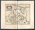
"Xantung, Sinarum Imperii provincia quarta." (21632336863).jpg 3,691 × 3,025; 2.09 MB
-
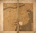
Da Ming yu di tu LOC 2002626776-1.jpg 9,658 × 9,049; 11.2 MB
-
Da Ming yu di tu LOC 2002626776-1.tif 9,658 × 9,049; 250.04 MB
-
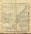
Guang yu tu - er juan LOC 2008623187-1.jpg 4,380 × 4,658; 4.68 MB
-
Guang yu tu - er juan LOC 2008623187-1.tif 4,380 × 4,658; 58.37 MB
-
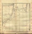
Guang yu tu - er juan LOC 2008623187-32.jpg 4,320 × 4,658; 4.47 MB
-
Guang yu tu - er juan LOC 2008623187-32.tif 4,320 × 4,658; 57.57 MB
-
Guang yu tu - er juan LOC 2008623187-33.jpg 4,340 × 4,658; 4.15 MB
-
Guang yu tu - er juan LOC 2008623187-33.tif 4,340 × 4,658; 57.84 MB
-
Guang yu tu - er juan LOC 2008623187-34.jpg 4,360 × 4,658; 4.32 MB
-
Guang yu tu - er juan LOC 2008623187-34.tif 4,360 × 4,658; 58.1 MB
-
Guang yu tu - er juan LOC 2008623187-40.jpg 4,380 × 4,658; 3.94 MB
-
Guang yu tu - er juan LOC 2008623187-40.tif 4,380 × 4,658; 58.37 MB
-
AMH-6721-KB Map of China and Korea.jpg 2,400 × 2,187; 1,001 KB
-
Xantvng - Atlas Maior, vol 11, map 16 - Joan Blaeu, 1667 - BL 114.h(star).11.(16).jpg 4,000 × 3,428; 1.94 MB
-
Der Jesuiten-Atlas der Kanghsi-Zeit - China und die Aussenlaender LOC 74650033-16.jpg 6,288 × 6,072; 3.87 MB
-
Der Jesuiten-Atlas der Kanghsi-Zeit - China und die Aussenlaender LOC 74650033-16.tif 6,288 × 6,072; 109.24 MB
-
Der Jesuiten-Atlas der Kanghsi-Zeit - China und die Aussenlaender LOC 74650033-8.jpg 7,114 × 8,854; 6.89 MB
-
Der Jesuiten-Atlas der Kanghsi-Zeit - China und die Aussenlaender LOC 74650033-8.tif 7,114 × 8,854; 180.21 MB
-
Der Jesuiten-Atlas der Kanghsi-Zeit - China und die Aussenlaender LOC 74650033-9.jpg 9,514 × 9,444; 8.89 MB
-
Der Jesuiten-Atlas der Kanghsi-Zeit - China und die Aussenlaender LOC 74650033-9.tif 9,514 × 9,444; 257.06 MB
-
Routes du Kiang-Nan - btv1b52505950j (35 of 46).jpg 8,621 × 1,955; 1.65 MB
-
Routes du Kiang-Nan - btv1b52505950j (37 of 46).jpg 6,963 × 1,918; 1.27 MB
-
Liang Huai yan chang ji si sheng xing yan tu. LOC gm71005050.jpg 19,944 × 11,840; 21.3 MB
-
Liang Huai yan chang ji si sheng xing yan tu. LOC gm71005050.tif 19,944 × 11,840; 675.59 MB
-
Da Qing fen sheng yu tu LOC 2002626726-1.jpg 5,280 × 4,534; 2.43 MB
-
Da Qing fen sheng yu tu LOC 2002626726-1.tif 5,280 × 4,534; 68.49 MB
-
Mouth of the Yangtze 1754.jpg 1,247 × 860; 161 KB
-
Zhi li ge sheng yu di quan tu - Zhang Zongjing - btv1b53103898v (17 of 69).jpg 5,102 × 4,405; 2.65 MB
-
Henan quan tu LOC 96685909.jpg 10,907 × 11,397; 16.63 MB
-
Henan quan tu LOC 96685909.tif 10,907 × 11,397; 355.65 MB
-
Tian xia zong yu tu. LOC 2002626780-1.jpg 3,847 × 3,193; 1.35 MB
-
Tian xia zong yu tu. LOC 2002626780-1.tif 3,847 × 3,193; 35.14 MB
-
1912 China map from National Geographic.jpg 6,980 × 5,326; 10.65 MB
-
1934年民生渠平面图.svg 512 × 255; 110 KB
-
310 of 'China in Transformation ... With ... maps and diagrams' (11291250283).jpg 1,287 × 1,142; 415 KB
-
312 of 'China in Transformation ... With ... maps and diagrams' (11245748964).jpg 1,430 × 1,961; 839 KB
-
Atlas Van der Hagen-KW1049B13 039-XANTVNG SINARVM IMPERII PROVICIA QUARTA.jpeg 5,500 × 4,523; 3.67 MB
-
Bassin-du-fleuve-jaune.png 2,239 × 1,183; 112 KB
-
China Loess Plateau and Ordos Desert.png 2,160 × 1,100; 155 KB
-
China Loess Plateau.png 2,160 × 1,100; 145 KB
-
Evariste Huc carte voyage clear.png 903 × 734; 549 KB
-
Evariste Huc carte voyage.jpg 3,559 × 2,794; 2.1 MB
-
Evariste Huc carte voyage.png 903 × 734; 677 KB
-
Fluvi Jaune - Topografia dau bacin.png 2,245 × 1,187; 440 KB
-
Huang He nan he tu. LOC gm71005024.jpg 23,436 × 5,064; 15.35 MB
-
Huang He nan he tu. LOC gm71005024.tif 23,436 × 5,064; 339.55 MB
-
Huanghemap zh-hans.png 2,160 × 1,100; 152 KB
-
Huanghemap zh-hant.png 2,160 × 1,100; 158 KB
-
Huanghemap.png 2,160 × 1,100; 94 KB
-
HuangHeZmenyDolnihoToku.PNG 665 × 440; 33 KB
-
Major cities along the Yellow River.svg 680 × 320; 8 KB
-
Map of Asia, Mitchell's School Atlas LOC 2007633727-13 (cropped).jpg 3,117 × 2,378; 1.79 MB
-
Map of Tartary, Thibet, and China.png 2,951 × 2,262; 6.01 MB
-
Mitchell's school atlas LOC 2007633727-13.jpg 3,402 × 2,814; 1.97 MB
-
Mitchell's school atlas LOC 2007633727-13.tif 3,402 × 2,814; 27.39 MB
-
Physical map of Tibet.png 833 × 490; 446 KB
-
Shandong Sheng Huang He tu. LOC gm71005026.jpg 21,955 × 6,164; 12.17 MB
-
Shandong Sheng Huang He tu. LOC gm71005026.tif 21,955 × 6,164; 387.18 MB
-
Topografic map of Tibetan Plateau.png 1,365 × 732; 663 KB
-
Xantung, sinarum imperii provincia quarta - (tiré du P. Martini) - btv1b5963044d.jpg 5,896 × 4,832; 4.73 MB
-
Yangtze River and Yellow River.gif 2,185 × 1,790; 80 KB
-
Yellow River course changes.gif 583 × 452; 983 KB
-
Yellow River watercourse change 1855.svg 341 × 274; 271 KB
-
Yellow River watercourse changes en.png 1,087 × 852; 251 KB
-
Yellow River watercourse changes en.svg 512 × 410; 275 KB
-
Yellow River watercourse changes.svg 341 × 274; 372 KB
-
Yellow river.svg 680 × 320; 3 KB
-
Yellowrivermap copy copy.jpg 410 × 494; 273 KB
-
Yellowrivermap-2.jpg 1,100 × 544; 140 KB
-
Yellowrivermap-fr.png 2,497 × 1,293; 994 KB
-
Yellowrivermap-zh-hans.jpg 1,100 × 544; 554 KB
-
Yellowrivermap-zh-hant.jpg 1,100 × 544; 554 KB
-
Yellowrivermap.jpg 2,497 × 1,571; 1.19 MB
-
土默特右旗河流灌渠图.svg 512 × 323; 311 KB
-
民生渠平面略图1934年.svg 512 × 255; 84 KB
-
黄河流域主要城市.svg 680 × 320; 9 KB

