Category:Maps of the Valley of the Kings
Jump to navigation
Jump to search
Media in category "Maps of the Valley of the Kings"
The following 35 files are in this category, out of 35 total.
-
Map of the Valley of the Kings.jpeg 2,076 × 1,160; 185 KB
-
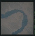
Tutankhamen map Valle Re Nilo space LandSat.jpg 800 × 708; 93 KB
-
Tutankhamen map Valle Re Nilo space STS026-041-058.jpg 5,104 × 5,104; 18.06 MB
-
Valley of the Kings from space STS026-041-058.tif 5,700 × 5,900; 112.83 MB
-
KV 35 Tomb Valley of the kings (cropped) (cropped).png 850 × 596; 1.1 MB
-
KV 35 Tomb Valley of the kings (cropped).png 866 × 616; 1.15 MB
-
KV 35 Tomb Valley of the kings.png 890 × 637; 1.25 MB
-
18AssePiegato.png 351 × 563; 8 KB
-
19AsseDisall.png 367 × 633; 9 KB
-
20AsseAllin.png 375 × 665; 9 KB
-
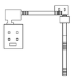
Tomba eix parallel.png 221 × 846; 2 KB
-
Belzoni's Valley of the Kings.jpg 3,967 × 5,205; 9.32 MB
-
Bentaxis.png 425 × 473; 2 KB
-
Burger DolinaKraljev Skica.jpg 400 × 582; 79 KB
-
By ovedc - KV2 - 1.jpg 5,312 × 2,988; 3.13 MB
-
By ovedc - KV2 - 2.jpg 5,312 × 2,988; 3.39 MB
-
East Valley of the Kings Sketch Map (Topo).png 1,030 × 794; 346 KB
-
East Valley of the Kings Sketch Map.jpg 1,030 × 794; 51 KB
-
East Valley of the Kings Sketch Map.png 1,030 × 794; 201 KB
-
Flickr - Gaspa - Valle dei Re, entrata.jpg 2,048 × 1,361; 363 KB
-
GD-EG-KV-map.png 397 × 443; 9 KB
-
Karte Tal der Könige 01.jpg 1,691 × 2,471; 792 KB
-
Karte Tal der Könige 02.jpg 3,123 × 2,233; 3.12 MB
-
KV-Wilkinson1830.jpg 4,000 × 2,712; 5.62 MB
-
Le plan de la Vallée des Rois (Thèbes ouest) (2084392213).jpg 800 × 600; 98 KB
-
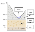
StratiValle.png 496 × 399; 62 KB
-
The Theban Necropolis Sheet C-3 Valley of the Kings.png 2,560 × 1,994; 8.59 MB
-
UK geologie.png 500 × 450; 29 KB
-
Valley of the Kings - geology stratification-ar.png 500 × 450; 28 KB
-
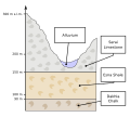
Valley of the Kings - geology stratification-en.svg 500 × 450; 24 KB
-
Valley of the Kings - geology stratification.svg 500 × 450; 27 KB
-
Valley of the Kings with the Constellations.jpeg 1,700 × 2,200; 1.18 MB
-
West Valley of the Kings Sketch Map (Topo).png 1,131 × 606; 247 KB


