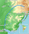
Category:Maps of the Uruguay River
Jump to navigation
Jump to search
Media in category "Maps of the Uruguay River"
The following 13 files are in this category, out of 13 total.
-
River uruguay map.PNG 866 × 1,302; 34 KB
-
Admiralty Chart No 2039 Rivers Uruguay, Paraná and Paraguay, Published 1952.jpg 8,249 × 11,248; 22.41 MB
-
Bacia Rio Uruguai Locali MDE.jpg 2,716 × 2,240; 5.37 MB
-
IlhaBrasileira.png 825 × 794; 44 KB
-
Map of the Uruguay River from Yapeyu to the Farm of Sn. Gregorio WDL189.png 1,024 × 1,399; 1.82 MB
-
Mapa hidro Rio Grande do Sul.gif 762 × 480; 28 KB
-
Paso de Hervidero.jpg 1,164 × 525; 297 KB
-
Reka Urugvaj-zemljevid.png 866 × 1,302; 18 KB
-
River uruguay map-2.PNG 399 × 600; 36 KB
-
Uruguay (fleuve).png 465 × 542; 423 KB
-
Uruguayrivermap.png 1,000 × 1,007; 217 KB


