Category:Maps of the United Kingdom of the Netherlands
Jump to navigation
Jump to search
Media in category "Maps of the United Kingdom of the Netherlands"
The following 26 files are in this category, out of 26 total.
-
1815-VerenigdKoninkrijkNederlanden Arabic.jpg 921 × 1,300; 746 KB
-
1815-VerenigdKoninkrijkNederlanden-de.svg 742 × 1,042; 624 KB
-
1815-VerenigdKoninkrijkNederlanden-en.svg 791 × 1,112; 209 KB
-
1815-VerenigdKoninkrijkNederlanden-fr.svg 742 × 1,042; 550 KB
-
1815-VerenigdKoninkrijkNederlanden-mk.svg 791 × 1,112; 430 KB
-
1815-VerenigdKoninkrijkNederlanden.svg 742 × 1,042; 743 KB
-
1816 François Bohn Nieuwe kaart van het Koningrijk der Nederlanden.jpg 1,340 × 1,806; 567 KB
-
1816 Weygand Nouvelle carte du Royaume des Pays-Bas.jpg 556 × 788; 238 KB
-
1827 Carte routière du Royaume des Pays-Bas, comprenant la Hollande et la Belgique.pdf 1,239 × 1,752, 2 pages; 3.02 MB
-
1829 Félix Delamarche Royaume des Pays-Bas.jpg 800 × 800; 152 KB
-
1830 Weygand (green border) Nouvelle carte de poste du Royaume des Pays-Bas.jpg 1,001 × 1,439; 1.78 MB
-
1830 Weygand (red border) Nouvelle carte de poste du Royaume des Pays-Bas.jpg 1,000 × 1,422; 927 KB
-
Carte routière du Royaume des Pays-Bas 1827 title.png 754 × 881; 819 KB
-
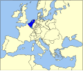
LocationUKN.png 250 × 115; 6 KB
-
Map-Europe 1815-Netherlands.svg 9,086 × 7,672; 1.73 MB
-
Moresnet.png 413 × 515; 5 KB
-
Napoleonic Wars War of the Seventh Coalition.png 1,357 × 628; 35 KB
-
Nieuwe Kaart Koningrijk der Nederlanden en Hertogdom Luxemburg C van Baarsel 1815.jpg 4,711 × 6,105; 12.34 MB
-
Reino Unido de los Países Bajos en 1815-es.svg 791 × 1,112; 527 KB
-
United Kingdom of the Netherlands 1815.svg 450 × 456; 700 KB
-
United Kingdom of the Netherlands.png 800 × 550; 81 KB
-
Verenigd Koninkrijk der Nederlanden (tot 1830).png 628 × 912; 121 KB
-
荷蘭聯合王, 1815年-1839年.svg 742 × 1,042; 186 KB


