Category:Maps of the Transkei
Jump to navigation
Jump to search
Media in category "Maps of the Transkei"
The following 12 files are in this category, out of 12 total.
-
 LocationBantoustanTranskei.PNG 250 × 115; 5 KB
-
 LocationTranskei.svg 1,000 × 500; 2.76 MB
-
 Map of Transkei with boundary changes from independence to dissolution-de.svg 1,000 × 900; 1.76 MB
-
 Map of Transkei with boundary changes from independence to dissolution.svg 2,000 × 1,800; 1.94 MB
-
 Map of Transkei.svg 889 × 822; 1.08 MB
-
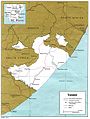
 MapBantoustanTranskei.PNG 370 × 323; 17 KB
-
 SouthAfricaBantustanTranskei.png 200 × 181; 17 KB
-
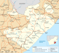
 Topographic map of the Transkei.svg 1,039 × 962; 2.26 MB
-
 Transkei 78.jpg 1,046 × 1,386; 260 KB
-
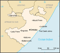
 Transkei in South Africa.svg 807 × 711; 225 KB
-
 Transkei. LOC 81692122.jpg 3,195 × 4,175; 951 KB
-
 Transkei. LOC 81692122.tif 3,195 × 4,175; 38.16 MB