Category:Maps of the Three Kingdoms of Korea
Jump to navigation
Jump to search
Subcategories
This category has only the following subcategory.
M
Media in category "Maps of the Three Kingdoms of Korea"
The following 52 files are in this category, out of 52 total.
-
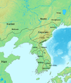
375年的朝鲜三国.png 437 × 533; 387 KB
-
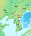
476年的朝鲜三国.png 507 × 599; 410 KB
-
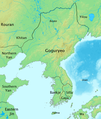
576年的朝鲜三国.png 437 × 599; 377 KB
-
Ancient Korea Map Byeonhan.png 2,000 × 1,657; 807 KB
-
Cheolli Jangseong.png 670 × 725; 687 KB
-
Dolmen in korea.jpg 356 × 494; 87 KB
-
Dolmen in Korea.png 2,160 × 3,817; 3.36 MB
-
Drie koninkryke van Korea.png 660 × 830; 14 KB
-
History of Korea (Goguryeo) 476 jp.png 1,261 × 1,490; 2.24 MB
-
History of Korea 375 ja.png 1,058 × 1,450; 1.87 MB
-
History of Korea 476 jp.png 1,261 × 1,490; 2.24 MB
-
History of Korea 576 ja.png 1,058 × 1,450; 2.1 MB
-
History of Korea-001.png 970 × 1,146; 570 KB
-
History of Korea-100.png 970 × 1,146; 860 KB
-
History of Korea-204.png 970 × 1,146; 569 KB
-
History of Korea-300.png 970 × 1,146; 864 KB
-
History of Korea-315.png 970 × 1,146; 858 KB
-
History of Korea-375.png 1,058 × 1,450; 1.88 MB
-
History of Korea-410.png 970 × 1,146; 864 KB
-
History of Korea-476-es.svg 685 × 887; 21.72 MB
-
History of Korea-476.PNG 970 × 1,146; 866 KB
-
History of Korea-576 ko.png 1,058 × 1,450; 1.87 MB
-
History of Korea-576.png 1,058 × 1,450; 2.16 MB
-
History of Korea-645.png 1,289 × 915; 1.57 MB
-
History of Korea-Three Kingdoms Period-375 CE-2-es.svg 349 × 452; 6.03 MB
-
History of Korea-Three Kingdoms Period-375 CE-ar.png 1,021 × 1,257; 358 KB
-
History of Korea-Three Kingdoms Period-375 CE.gif 1,021 × 1,257; 212 KB
-
History of Korea-Three Kingdoms Period-476 CE-ar.png 1,012 × 1,196; 549 KB
-
History of Korea-Three Kingdoms Period-476 CE.gif 1,012 × 1,196; 341 KB
-
History of Korea-Three Kingdoms Period-576 CE-2-es.svg 349 × 452; 6.12 MB
-
History of Korea-Three Kingdoms Period-576 CE-ar.png 1,014 × 1,198; 533 KB
-
History of Korea-Three Kingdoms Period-576 CE.gif 1,014 × 1,198; 332 KB
-
Later Three Kingdoms (後三國).jpg 4,026 × 5,787; 830 KB
-
Map of Goguryeo (476).png 1,000 × 1,500; 202 KB
-
Map of Goguryeo.jpg 2,232 × 2,880; 647 KB
-
Three Kingdoms of Korea Map-es.svg 357 × 461; 513 KB
-
Three Kingdoms of Korea Map-zh.png 680 × 830; 69 KB
-
Three Kingdoms of Korea blank.png 660 × 830; 11 KB
-
Three Kingdoms of Korea Map.png 658 × 827; 30 KB
-
Samhan Period Byeonhan Shaded.jpg 595 × 610; 258 KB
-
The invasion of Goguryeo.png 400 × 400; 70 KB
-
Three Kingdoms Korean peninsula Chinese.png 616 × 591; 75 KB
-
Three Kingdoms of Korea Map ja.png 658 × 827; 16 KB
-
Three Kingdoms of Korea Map k.png 660 × 830; 27 KB
-
Three Kingdoms of Korea Map pl.png 660 × 830; 46 KB
-
Three Kingdoms of Korea Map rus.PNG 658 × 827; 16 KB
-
Tri kralovstvi Koreje mapa.png 658 × 827; 9 KB
-
سه پادشاهی کره.png 2,232 × 2,880; 1.5 MB
-
朝鲜三国时代底图.jpg 2,232 × 2,880; 431 KB
-
百済と遼西の位置関係.png 274 × 308; 23 KB
-
高句丽鼎盛时期的版图.jpg 507 × 599; 128 KB
-
초등대한역사 제2편 1.jpg 333 × 454; 63 KB


