Category:Maps of the Three Kingdoms
Jump to navigation
Jump to search
- 中文(臺灣):三國時期地圖的媒體集。
Media in category "Maps of the Three Kingdoms"
The following 79 files are in this category, out of 79 total.
-
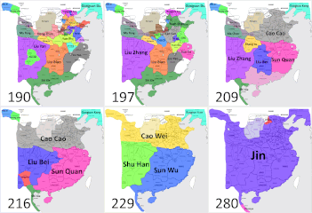
3K v3.gif 862 × 887; 4.57 MB
-
3Kv4.gif 862 × 887; 4.62 MB
-
Alotmorethan3kingdoms.gif 862 × 887; 4.06 MB
-
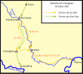
Bataille de Changban.svg 461 × 409; 25 KB
-
Battle of Yiling.png 1,097 × 773; 1.75 MB
-
Cao Cao's conquest of northern China 200–207.png 544 × 571; 628 KB
-
Cao exp200-220.png 282 × 219; 7 KB
-
Cao Pi's invasions of Eastern Wu.png 800 × 600; 60 KB
-
Changbanzhizhan.png 458 × 403; 65 KB
-
China - Tres Reiaumes (vèrs 250).png 710 × 598; 75 KB
-
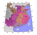
China 5 km.jpg 560 × 550; 98 KB
-
China 5.jpg 560 × 550; 94 KB
-
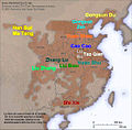
Chinese Warlords in 190AD post-Dong Zhuo War.jpg 1,650 × 1,950; 235 KB
-
Conquest of Shu-Han.jpg 800 × 600; 199 KB
-
ConquestofShubyWei.png 800 × 600; 50 KB
-
Eastern Han in 198.png 555 × 545; 491 KB
-
End of Han Dynasty Warlords-ar.png 1,272 × 901; 71 KB
-
End of Han Dynasty Warlords.png 1,275 × 902; 61 KB
-
Gongsun territory.png 170 × 141; 3 KB
-
GuanqiuJianWenQinRevolt.png 800 × 600; 56 KB
-
Ja-Chibizhizhan.png 792 × 600; 161 KB
-
Jian'an Commanderies.png 2,500 × 1,800; 5.28 MB
-
Jian'an Commanderies.svg 3,125 × 2,250; 7.37 MB
-
Jindestroywu in english.png 691 × 308; 296 KB
-
Jindestroywu.png 691 × 308; 63 KB
-
Les Trois Royaumes en 262.png 556 × 537; 76 KB
-
Longzhong Plan-zh-classical.png 436 × 556; 286 KB
-
Longzhong Plan.jpg 436 × 556; 79 KB
-
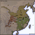
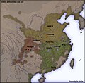
Map of China During the Period of the Three Kingdoms.jpg 1,578 × 1,183; 317 KB
-
Mapof3kingdoms.jpg 2,600 × 2,479; 388 KB
-
Names v2.gif 862 × 887; 4.58 MB
-
Saam Gwok 262 CE unconditional.png 556 × 537; 87 KB
-
Saam Gwok 262 CE.png 556 × 537; 47 KB
-
Sanguo map.jpg 550 × 515; 88 KB
-
Sanguo.jpg 403 × 206; 13 KB
-
Senyors de la guerra en el 194.jpg 555 × 545; 169 KB
-
Sun Ce Territory.jpg 584 × 360; 60 KB
-
Sun Quan's independence campaign.png 800 × 571; 63 KB
-
Tam Quoc 208.jpg 555 × 545; 71 KB
-
Tam Quoc 215.jpg 555 × 545; 69 KB
-
Tao qian.png 245 × 216; 6 KB
-
The Eastern Wu Dynasty map of Nanjing,by Chen Yi.jpg 640 × 453; 79 KB
-
The three kingdoms-ar.jpg 771 × 594; 144 KB
-
Third Rebellion in Shouchun Map.png 601 × 400; 546 KB
-
Three Kingdoms of Ancient China.png 1,174 × 964; 1.65 MB
-
Three Kingdoms timelapse.gif 1,200 × 1,138; 18.35 MB
-
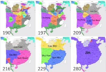
Three Kingdoms v.2.gif 862 × 887; 4.7 MB
-
Three Kingdoms-ar.png 1,288 × 912; 399 KB
-
Three Kingdoms.png 1,288 × 912; 558 KB
-
ThreeKingdoms262.png 21,047 × 14,882; 8.91 MB
-
Topographical 3K gif.gif 1,344 × 1,275; 31.64 MB
-
Trois royaumes de Chine carte.svg 920 × 1,006; 499 KB
-
W020090119302411160004.jpg 500 × 433; 55 KB
-
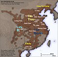
Warlords in 194.jpg 555 × 545; 139 KB
-
Warlords in 199.jpg 555 × 545; 125 KB
-
Warlords in 208.jpg 555 × 545; 132 KB
-
Warlords in 215.jpg 555 × 545; 133 KB
-
Wei-Wu-Shun Dynasties 220 - 280 (AD).PNG 801 × 741; 45 KB
-
Wu region sun ce.jpg 806 × 485; 338 KB
-
Xina, periode dels Tres Regnes.jpg 560 × 550; 132 KB
-
Zhuge Liang 1st and 2nd Northern Expeditions.png 1,272 × 899; 2.3 MB
-
Zhuge Liang 3rd Northern Expedition.png 1,272 × 900; 2.41 MB
-
Zhuge Liang 4th and 5th Northern Expeditions.png 1,272 × 899; 2.29 MB
-
Zhuge Liang's Southern Campaign.png 795 × 1,117; 464 KB
-
三国全图.png 1,504 × 1,061; 2.1 MB
-
三国行政区划(简).png 935 × 964; 1.06 MB
-
三国行政区划(繁).png 935 × 964; 1.07 MB
-
三国行政区划-五丈原.png 256 × 284; 39 KB
-
三国行政区划-五丈原.svg 768 × 852; 170 KB
-
三國264.jpg 771 × 595; 295 KB
-
三國266.jpg 935 × 964; 552 KB
-
三國時期行政區劃圖.png 800 × 600; 348 KB
-
三國時期行政區劃圖.svg 778 × 596; 1.23 MB
-
三國時期行政區劃圖2.png 625 × 479; 402 KB
-
交州264.jpg 800 × 555; 243 KB
-
交阯之亂263.jpg 600 × 523; 306 KB
-
晋灭吴之战03.jpg 622 × 492; 166 KB
-
西陵之戰272.jpg 800 × 583; 284 KB
-
鍾會叛亂.png 673 × 423; 512 KB

