Category:Maps of the Temple Mount
Jump to navigation
Jump to search
Subcategories
This category has the following 5 subcategories, out of 5 total.
Media in category "Maps of the Temple Mount"
The following 71 files are in this category, out of 71 total.
-
MACCOUN(1899) p097 JERUSALEM - TIME OF DAVID AND SOLOMON.jpg 1,991 × 3,442; 2.93 MB
-
MACCOUN(1899) p125 JERUSALEM - TIME OF HEZEKIAH.jpg 1,986 × 3,554; 2.99 MB
-
MACCOUN(1899) p133 JERUSALEM - TIME OF NEHEMIAH.jpg 1,983 × 3,466; 3.01 MB
-
MACCOUN(1899) p179 JERUSALEM, TIME OF HEROD.jpg 1,978 × 3,550; 3.23 MB
-
MACCOUN(1899) p181 JERUSALEM, PLAN OF THE TEMPLE AREA.jpg 2,034 × 3,598; 2.28 MB
-
MACCOUN(1899) p183 JERUSALEM, THE TEMPLE BUILDING.jpg 1,962 × 3,582; 2.1 MB
-
MACCOUN(1899) p191 JERUSALEM - TIME OF AGRIPPA.jpg 1,986 × 3,562; 3.25 MB
-
MACCOUN(1899) p205 ROMAN JERUSALEM 325 TO 636 A.D. - AELIA.jpg 1,972 × 3,464; 3.27 MB
-
MACCOUN(1899) p211 MOSLEM JERUSALEM - 636 TO 1099 A.D. BAIT-AL-MAKDIS.jpg 1,978 × 3,562; 3.08 MB
-
MACCOUN(1899) p217 JERUSALEM - TIME OF THE CRUSADERS.jpg 1,987 × 3,400; 3.07 MB
-
MACCOUN(1899) p219 AL KUDS - JERUSALEM OF TO-DAY.jpg 1,963 × 3,372; 3 MB
-
MACCOUN(1899) p221 PLAN OF THE HARAM AREA AT THE PRESENT TIME.jpg 2,018 × 3,590; 1.92 MB
-
225 of 'Buried Cities and Bible Countries' (11213494123).jpg 2,576 × 3,391; 1.84 MB
-
3rdTemple31.png 843 × 821; 11 KB
-
3rdTemple33.png 963 × 814; 17 KB
-
3rdTemple34.png 953 × 832; 16 KB
-
3rdTemple35.png 912 × 806; 11 KB
-
3rdTemple36.png 865 × 835; 16 KB
-
Birket Israel 1915.jpg 631 × 544; 91 KB
-
Carte Mission Parker.jpg 659 × 996; 876 KB
-
Charles William Wilson. Ordnance Survey of Jerusalem. 1865. II.jpg 14,636 × 10,210; 16.63 MB
-
Charles William Wilson. Ordnance Survey of Jerusalem. 1865.jpg 14,571 × 10,210; 16.46 MB
-
Chramova hora v1.jpg 1,029 × 1,088; 773 KB
-
Chramova hora v1.png 494 × 523; 35 KB
-
EB1911 Temple - Plan of Herod's Temple and Courts.jpg 854 × 1,015; 277 KB
-
Edward Robinson c.1840 Temple Vaults.jpg 2,903 × 4,685; 3.43 MB
-
Gezicht op de Tempelberg van Jeruzalem vanuit het oosten, RP-P-2005-95.jpg 6,028 × 4,852; 4.18 MB
-
Ground plan of Herod's Temple & environment according to Dr. Schick. LOC matpc.04265.tif 4,241 × 5,760; 23.3 MB
-
Har HaBayit map.jpg 443 × 566; 24 KB
-
Har HaBayit map1 en.jpg 443 × 566; 61 KB
-
Har HaBayit map1.jpg 443 × 566; 34 KB
-
Haram-al-sharif-plan-1890.jpg 909 × 847; 135 KB
-
Karte Jerusalem Tempel (1).jpg 256 × 339; 22 KB
-
Karte Jerusalem Tempel (2).jpg 512 × 768; 74 KB
-
Leontopolis site.svg 790 × 790; 45 KB
-
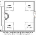
Leshacot nashim.png 1,000 × 972; 91 KB
-
RosenBuraqMosque.jpg 500 × 964; 80 KB
-
Tempelberg Karte-dt.jpg 1,134 × 1,448; 462 KB
-
Temple Mount Gates numbered.svg 480 × 660; 9 KB
-
The survey of Western Palestine-Jerusalem (1884) (14591905908).jpg 2,160 × 3,164; 829 KB
-
Warren11.jpg 819 × 572; 63 KB
-
Warren11a.jpg 819 × 572; 63 KB
-
WilsonHoshAlBurak.png 1,883 × 3,087; 1.63 MB
-
Постройки на Храмовой горе.jpg 443 × 566; 28 KB
-
مصادر المياه في المسجد الاقصى.jpg 520 × 719; 60 KB
-
مصادر المياه في المسجد الاقصى.png 520 × 719; 79 KB


