Category:Maps of the Socialist Federal Republic of Yugoslavia
Jump to navigation
Jump to search
Subcategories
This category has the following 2 subcategories, out of 2 total.
Media in category "Maps of the Socialist Federal Republic of Yugoslavia"
The following 57 files are in this category, out of 57 total.
-
1963 Skopje earthquake.png 251 × 271; 71 KB
-
1967 data of Yugoslavia and Hungary.jpg 3,952 × 2,896; 1.6 MB
-
1988Yugoslavia map detail.gif 800 × 628; 23 KB
-
1998 Military Geography of Former Yugoslavia (30249737963).jpg 2,539 × 3,288; 6.59 MB
-
AtlBalk1945-90.jpg 318 × 327; 168 KB
-
Autopista RFS Iugoslavia.svg 512 × 394; 55 KB
-
Balkans Animation 1800-2008.gif 744 × 618; 542 KB
-
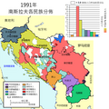
Bevoelkerungsgruppen-Jugoslawien SIM.png 700 × 700; 193 KB
-
Bevoelkerungsgruppen-Jugoslawien TR.png 700 × 700; 213 KB
-
Bývalá Jugoslávie CS.png 1,887 × 1,192; 37 KB
-
CCR SE Euroa e Turchia - RCC SE Europe and Turkey.jpg 710 × 494; 97 KB
-
Decriminalization of homosexuality in Yugoslavia.png 2,364 × 2,048; 598 KB
-
Dekriminalizacija homoseksualnosti u Jugoslaviji 1977..jpg 692 × 600; 103 KB
-
Former Yugoslavia - DPLA - 148185d5ccf1fbac7084a6a5b27df2a2.jpg 2,552 × 3,280; 4.71 MB
-
Former Yugoslavia 2006 cht.png 1,887 × 1,192; 133 KB
-
Former Yugoslavia template.png 2,000 × 1,910; 397 KB
-
General map of yugoslavia (1945-1991) (HR labels).png 3,509 × 2,478; 8.3 MB
-
General map of yugoslavia (1945-1991) (SH labels).png 3,509 × 2,478; 8.3 MB
-
General map of yugoslavia (1945-1991) (SL labels).png 3,509 × 2,478; 8.3 MB
-
Greater Serbia in Yugoslavia.png 1,504 × 1,163; 59 KB
-
Hungary, Yugoslavia, and Albania - DPLA - 26190356f5b0dab069d09709ef695c85.jpg 8,338 × 9,444; 8.26 MB
-
Hungary, Yugoslavia, and Albania - DPLA - 3ab357c59dde41bd40feaa5bb6eba60f.jpg 8,352 × 9,451; 6.15 MB
-
Hungary, Yugoslavia, and Albania - DPLA - 6c53ce7e7a906226ed08ac8e9cc3b22e.jpg 8,388 × 9,443; 7.57 MB
-
Italy Yugoslavia Locator.png 1,600 × 1,200; 833 KB
-
Joego klein wiki.png 250 × 225; 20 KB
-
Jugoslawische-EM-Platzierungen.PNG 1,200 × 1,000; 69 KB
-
Location of Yugoslavia.png 250 × 115; 7 KB
-
Location Yugoslavia.png 439 × 590; 148 KB
-
LocationYugoslavia.png 250 × 115; 6 KB
-
LocationYugoslavia2.png 250 × 345; 13 KB
-
NavodniSporazumPavelicStojadinovicDetalji.png 1,000 × 824; 116 KB
-
SFR Yugoslavia autoput cs.svg 1,557 × 1,205; 146 KB
-
SFR Yugoslavia autoput de.svg 1,475 × 1,136; 72 KB
-
SFR Yugoslavia autoput it.svg 1,388 × 1,072; 84 KB
-
SFR Yugoslavia autoput mk.svg 1,475 × 1,136; 160 KB
-
SFR Yugoslavia autoput pl.svg 1,557 × 1,205; 146 KB
-
SFR Yugoslavia autoput sr.svg 1,557 × 1,205; 53 KB
-
SFR Yugoslavia autoput-pt.svg 1,557 × 1,205; 145 KB
-
SFR Yugoslavia.png 1,999 × 1,999; 540 KB
-
Sfrj.png 3,509 × 2,478; 8.3 MB
-
SFRJ.svg 774 × 592; 33 KB
-
SFRYmap.PNG 1,600 × 1,200; 836 KB
-
Sporazum Pavelic-Stojadinovic.png 1,000 × 824; 63 KB
-
SporazumPavelicStojadinovic.png 1,000 × 824; 74 KB
-
World Factbook (1982) Yugoslavia.jpg 588 × 589; 96 KB
-
World Factbook (1990) Yugoslavia.jpg 556 × 509; 94 KB
-
Yugo template.png 405 × 355; 38 KB
-
Yugoslavia 1956-1990.svg 450 × 456; 475 KB
-
Yugoslavia 76767676.PNG 941 × 824; 25 KB
-
Yugoslavia silhouette grey.svg 340 × 286; 181 KB
-
Yugoslavia-CIA WFB Map.png 690 × 608; 398 KB
-
Zone triest 1947-1954.jpg 283 × 406; 23 KB
-
Приобретение территорий после распада Югославии.svg 512 × 392; 55 KB
-
유고슬라비아 내 대세르비아.png 1,504 × 1,163; 75 KB


