Category:Maps of the Seven Years' War
Jump to navigation
Jump to search
Subcategories
This category has the following 7 subcategories, out of 7 total.
*
C
L
M
Media in category "Maps of the Seven Years' War"
The following 95 files are in this category, out of 95 total.
-

-

-
 1756 Siebenjähriger Krieg Pirna Plan von dem Sächsischen und Preußischen Lager bey Pirna.jpg 3,072 × 2,048; 2.62 MB
-
 1757 Memel detail of map Russians March to Prussia BPL 14326.png 559 × 714; 886 KB
-

-
 A short history of England and the British Empire (1915) (14580642538).jpg 1,828 × 2,608; 737 KB
-
 Angriff und Ersteigung der Festung Schweidnitz den 1ten October 1761.jpg 7,098 × 6,937; 13.53 MB
-

-
 Battle of Strehla (L. Therbu, G. J. Cöntgen - detail).jpg 1,130 × 1,151; 791 KB
-
 Battle of Strehla (L. Therbu, G. J. Cöntgen, c. 1760).jpg 1,342 × 2,000; 1.28 MB
-
 Battle of Strehla - battleplan.jpg 900 × 698; 153 KB
-
 Beaurain Carte D'Allemagne 1765.jpg 4,932 × 3,605; 5.95 MB
-
 Belagerung der Festung Schweidnitz im Jahr 1762. Jauernicker Fort mit Laufgräben.jpg 6,458 × 8,565; 7.06 MB
-
 Belagerung von Kassel vom 1ten bis 28ten März 1761.jpg 4,934 × 6,242; 5.27 MB
-

-
 Carte Guerre de Sept Ans Europe.PNG 884 × 643; 77 KB
-
 Croquis des Reuster Berges und der umliegenden Gegend.jpg 5,292 × 4,629; 3.26 MB
-

-
 Dresden 1759.jpg 685 × 547; 378 KB
-
 Europe 1748-1766 blank.png 3,872 × 2,761; 855 KB
-
 Europe 1748-1766 en.png 3,872 × 2,761; 1.26 MB
-
 Europe 1748-1766.png 3,872 × 2,761; 1.47 MB
-
 Fort Nro. I oder Galgenfort.jpg 4,430 × 5,707; 2.35 MB
-

-

-
-

-

-

-

-
 Gefecht bei Burkersdorf und Leutmannsdorf am 21sten Juli 1762.jpg 8,409 × 8,791; 9.65 MB
-
 Gefecht bei Doebeln am 12ten Mai 1762.jpg 8,330 × 9,662; 17.76 MB
-
 Gefecht bei Reichenbach am 16ten August 1762.jpg 8,565 × 9,098; 15.39 MB
-
 GuerraSieteAños comb.png 4,974 × 2,519; 619 KB
-
 Hessian theatre of war in 1760.jpg 1,280 × 960; 1.35 MB
-

-
 Karte - Feldzug 1760 im Westen.png 2,637 × 1,892; 595 KB
-
 Kuestrin.jpg 1,740 × 997; 1.98 MB
-
 Map for the Silesian and Seven Years Wars.jpg 1,672 × 1,238; 438 KB
-
 Map river weser kassel to bremerhaven.png 373 × 607; 26 KB
-
 Musalipatam Mschilipatnam port in 1759.jpg 1,216 × 998; 146 KB
-
 Münster - 1759.jpg 4,230 × 3,729; 7.11 MB
-

-
 Operations Charte für die ersten Ereignisse des Feldzuges von 1761 in Schlesien.jpg 6,001 × 4,542; 3.11 MB
-
 Operations Karte im Jahr 1759.jpg 13,534 × 11,785; 11.44 MB
-
 Partie septentrionale du landgraviat de Hesse-Cassel 1761.jpg 1,024 × 1,199; 376 KB
-
 Plan de Postitione del arme allier a 24. dez 1757 9106.jpg 3,032 × 4,613; 3.46 MB
-

-

-

-
 Plan der Belagerung von Cassel im Jahr 1762.jpg 6,654 × 4,843; 8.45 MB
-
 Plan der Schlacht bei Freyberg den 29ten October 1762.jpg 6,662 × 9,442; 26.52 MB
-
 Plan der Schlacht bei Kay am 23ten Juli 1759.jpg 6,873 × 5,597; 9.87 MB
-
 Plan des Gefechts bei Friedberg 1762.jpg 8,523 × 6,518; 13.12 MB
-
 Plan des Gefechts bei Gostyn am 15ten September 1761.jpg 4,961 × 6,234; 7.55 MB
-
 Plan des Gefechts bei Maxen den 20. Novemb. 1759.jpg 5,349 × 4,639; 7.23 MB
-
 Plan des Lagers bei Bunzelwitz vom 20ten August bis den 10ten September 1761.jpg 6,648 × 7,457; 9.44 MB
-
 Plan des Schlachtfeldes bei Lobositz am 1ten October 1756.jpg 4,930 × 6,259; 6.2 MB
-
 Plan défensif de Louisbourg en 1757.jpg 1,527 × 989; 499 KB
-
 Plan von Berlin 1760.jpg 10,906 × 6,803; 27.92 MB
-
 Plan von Damgarten 1759.jpg 940 × 548; 205 KB
-
 Plan von dem Gefecht bey Warburg den 31ten Julÿ 1760.jpg 5,411 × 4,648; 7.54 MB
-
 7yearswar-es.svg 1,410 × 1,120; 1.2 MB
-
 7yearswar.PNG 1,996 × 1,563; 908 KB
-
 Schlacht bei Leuthen am 5ten December 1757.jpg 5,977 × 5,146; 5.88 MB
-
 Schlacht bei Minden am 1 August 1759 01 (cropped).jpg 3,542 × 2,979; 4.23 MB
-
 Schlacht bei Minden am 1 August 1759 01.jpg 5,426 × 4,686; 5.98 MB
-
 Schlacht bei Minden am 1 August 1759 02.jpg 3,522 × 2,960; 4.15 MB
-
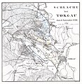 Schlacht bei Torgau den 3" November 1760 01.jpg 3,205 × 3,286; 3.97 MB
-
 Schlacht bei Torgau den 3" November 1760 02.jpg 5,535 × 4,668; 5.13 MB
-
 Seven Years' War - Interior lines, 1757.gif 1,094 × 851; 116 KB
-
 Seven Years' War - Operations in Bohemia, 1757.gif 1,104 × 859; 125 KB
-
 Seven Years' War - Operations in Saxony and Silesia, 1757.gif 1,106 × 860; 135 KB
-
 Seven Years' War - Operations, 1756.gif 1,099 × 854; 127 KB
-
 Seven Years' War - Withdrawal from Bohemia, 1757.gif 1,103 × 858; 121 KB
-
 SevenYearsWar.png 1,357 × 628; 41 KB
-
 Silezie1740.png 357 × 202; 143 KB
-
 Stettiner Haff - Battle of 1759.jpg 4,976 × 5,744; 2.73 MB
-
 Territory of Wetzlar 1760.jpg 1,056 × 1,408; 1,009 KB
-
 Tischbein Plan de Berlin 1748.jpg 2,871 × 4,208; 4.29 MB
-
-
 Verproviantirung von Göttingen im Januar 1761.jpg 6,008 × 5,163; 3.75 MB
-
 Warendorf - Karte des französischen Feldlagers 1757.jpg 1,058 × 721; 272 KB
-

-

-

-
 Карта Пруссии в семилетнюю войну. 18в (Материалы для истории инж.иск.1866г) e1cr.jpg 3,284 × 2,880; 1.86 MB
-
-

-

-

-

-

-

-

.jpg)


_(14580642538).jpg)


.jpg)
.jpg)


.jpg)


.jpg)


.jpg)
_e1cr.jpg)
.jpg)
.jpg)
.jpg)
._%D0%92%D0%BE%D0%B5%D0%BD%D0%BD%D0%B0%D1%8F_%D1%8D%D0%BD%D1%86%D0%B8%D0%BA%D0%BB%D0%BE%D0%BF%D0%B5%D0%B4%D0%B8%D1%8F_%D0%A1%D1%8B%D1%82%D0%B8%D0%BD%D0%B0_(%D0%A1%D0%B0%D0%BD%D0%BA%D1%82-%D0%9F%D0%B5%D1%82%D0%B5%D1%80%D0%B1%D1%83%D1%80%D0%B3,_1911-1915).jpg)
.jpg)
.jpg)
.jpg)
.jpg)