Category:Maps of the Sengoku period
Jump to navigation
Jump to search
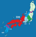
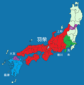
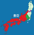
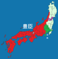
日本語: 戦国時代地図。
English: Maps of the Sengoku period.
Subcategories
This category has only the following subcategory.
M
Media in category "Maps of the Sengoku period"
The following 115 files are in this category, out of 115 total.
-
1498 Meio earthquake intensity.png 512 × 512; 37 KB
-
1534年(天文3年)時の戦国大名の配置図.jpg 13,816 × 11,629; 15.71 MB
-
1570 sengoku.png 451 × 282; 30 KB
-
1570 wiki.png 921 × 563; 235 KB
-
1586 Tensho earthquake intensity.png 512 × 512; 37 KB
-
Azuchimomoyama Japan br.png 930 × 900; 224 KB
-
Azuchimomoyama-japan.png 1,800 × 1,738; 978 KB
-
Battle of Tedorigawa-farsi.jpg 461 × 319; 50 KB
-
Battle of Tedorigawa-Farsi.svg 218 × 174; 31 KB
-
Borndied.jpg 450 × 515; 31 KB
-
C1510.png 1,064 × 1,079; 118 KB
-
C1520.png 1,064 × 1,079; 118 KB
-
C1530.png 1,064 × 1,079; 118 KB
-
C1550.png 1,064 × 1,079; 119 KB
-
C1560.png 1,064 × 1,079; 119 KB
-
C1570.png 1,064 × 1,079; 122 KB
-
C1575.png 1,064 × 1,079; 122 KB
-
C1580.png 1,064 × 1,079; 124 KB
-
Castle osino.jpg 2,682 × 1,904; 538 KB
-
F1584.png 5,320 × 5,395; 2.72 MB
-
Feudal Map of Japan between 1564-73.jpg 3,238 × 2,483; 5.97 MB
-
Itamij15.jpg 1,471 × 1,017; 227 KB
-
Japan map in the early 16th century.jpg 2,740 × 1,810; 1.31 MB
-
Japan provinces Serbian 1450.png 2,000 × 2,000; 361 KB
-
Japan provinces Serbian 1450b.png 2,000 × 2,000; 362 KB
-
Japan provinces Serbian 1560.png 2,000 × 2,000; 357 KB
-
Japan provinces Serbian 1560b.png 2,000 × 2,000; 358 KB
-
Japan provinces Serbian 1570.png 2,000 × 2,000; 358 KB
-
Japan provinces Serbian 1570b.png 2,000 × 2,000; 358 KB
-
Japan provinces Serbian 1570c.png 2,000 × 2,000; 358 KB
-
Japan-Owari 1555.png 510 × 601; 26 KB
-
Japo durant azuchi-momoya.jpg 621 × 600; 132 KB
-
JaponAzuchimomoyama.png 930 × 898; 124 KB
-
Kinai - Sengoku.png 531 × 714; 290 KB
-
Kinai - Sengoku.svg 531 × 714; 434 KB
-
Map Japan Genki-fa.svg 554 × 333; 62 KB
-
Map Japan Genki1-en.svg 443 × 266; 291 KB
-
Map Japan Genki1-es.svg 3,382 × 2,000; 317 KB
-
Map Japan Genki1.png 1,400 × 980; 174 KB
-
Map of 16th-century Japan Ukrainian.png 454 × 282; 33 KB
-
Map of Amago clan 1544.png 487 × 425; 32 KB
-
Map of Chōsokabe clan 1584.png 488 × 543; 58 KB
-
Map of Date clan 1589.png 386 × 394; 30 KB
-
Map of Hosokawa clan 1506.png 577 × 487; 38 KB
-
Map of Imagawa clan 1552.png 480 × 473; 46 KB
-
Map of Imagawa clan 1568.jpg 520 × 806; 87 KB
-
Map of Late Hōjō clan 1583.png 458 × 515; 46 KB
-
Map of Miyoshi clan 1554.png 494 × 469; 33 KB
-
Map of Mōri clan 1568.png 610 × 484; 54 KB
-
Map of Nagao clan 1560.png 435 × 561; 52 KB
-
Map of Oda clan 1582.png 619 × 580; 79 KB
-
Map of Ryūzōji clan 1579.png 495 × 500; 55 KB
-
Map of Saitō clan 1548.png 471 × 486; 36 KB
-
Map of Shimazu clan 1586.png 495 × 500; 43 KB
-
Map of Takeda clan 1572.png 451 × 501; 46 KB
-
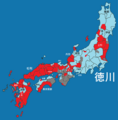
Map of Tokugawa clan.png 1,064 × 1,079; 154 KB
-
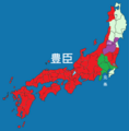
Map of Toyotomi clan 1591.png 1,064 × 1,079; 137 KB
-
Map of Uesugi clan 1454.png 494 × 504; 61 KB
-
Map of Ōtomo clan 1569.png 495 × 500; 46 KB
-
Map of Ōuchi clan 1542.png 388 × 403; 30 KB
-
Map-of-Saitō-clan-1548.png 1,148 × 1,035; 242 KB
-
Mikij31.jpg 2,827 × 2,419; 2.71 MB
-
Oda Nobunaga - 1540-1550.png 500 × 375; 55 KB
-
Oda Nobunaga - 1550-1560.png 500 × 375; 48 KB
-
Oda Nobunaga - 1560-1568.png 500 × 375; 45 KB
-
Oda Nobunaga - 1568-1570 (2).png 500 × 375; 49 KB
-
Oda Nobunaga - 1568-1570.png 500 × 375; 46 KB
-
Oda nobunaga toyotomi hideyoshi map of conquest farsi.gif 594 × 779; 34 KB
-
Oda nobunaga toyotomi hideyoshi map of conquest.gif 594 × 776; 31 KB
-
Old Chugoku Region-farsi.png 2,604 × 1,570; 1.63 MB
-
Old Chugoku Region.png 1,024 × 857; 156 KB
-
Ounin no Ran 1467.png 665 × 544; 115 KB
-
Provinces of Japan-Owari 1555.png 558 × 546; 17 KB
-
Sengoku - villes.png 1,152 × 1,385; 1.8 MB
-
Sengoku - villes.svg 1,151 × 1,385; 1.39 MB
-
Sengoku period 1467.png 768 × 496; 67 KB
-
Sengoku period 1490.png 1,064 × 1,079; 116 KB
-
Sengoku period 1500.png 1,064 × 1,079; 116 KB
-
Sengoku period 1540.png 1,064 × 1,079; 116 KB
-
Sengoku period 1565.png 1,064 × 1,079; 119 KB
-
Sengoku period 1570 besiege.png 634 × 616; 60 KB
-
Sengoku period 1570.png 634 × 616; 69 KB
-
Sengoku period 1572 besiege.png 838 × 692; 84 KB
-
Sengoku period 1572.png 838 × 692; 98 KB
-
Sengoku period 1576 besiege.png 926 × 882; 99 KB
-
Sengoku period 1576.png 926 × 882; 110 KB
-
Sengoku period 1580 kamon.png 5,320 × 5,395; 2.69 MB
-
Sengoku period 1582.png 1,064 × 1,079; 122 KB
-
Sengoku period 1584.png 1,064 × 1,079; 121 KB
-
Sengoku period 1585.png 1,064 × 1,079; 116 KB
-
Sengoku period 1586.png 1,064 × 1,079; 115 KB
-
Sengoku period 1587.png 1,064 × 1,079; 109 KB
-
Sengoku period 1588.png 1,064 × 1,079; 109 KB
-
Sengoku period 1589.png 1,064 × 1,079; 110 KB
-
Sengoku period 1590.png 1,064 × 1,079; 107 KB
-
Sengoku period 1591.png 1,064 × 1,079; 106 KB
-
Sengoku period 1600.png 1,064 × 1,079; 124 KB
-
Sengoku period 1614.png 1,064 × 1,079; 109 KB
-
Sengoku period-1600.png 1,064 × 1,079; 116 KB
-
Sengoku-period-1582.png 1,076 × 1,079; 121 KB
-
Sengoku-period-1584.png 1,064 × 1,079; 128 KB
-
Sengoku1560.png 1,064 × 1,079; 128 KB
-
Siege of Miki.gif 500 × 361; 19 KB
-
Siege of Odawara (1590) farsi.jpg 560 × 396; 88 KB
-
The escape of Imagawa Ujizane in 1568.jpg 3,625 × 2,550; 1.18 MB
-
Tokugawa Nobunaga territory.PNG 235 × 300; 8 KB
-
نقشه منطقه قبل از عملیات سیجو.jpg 700 × 472; 87 KB
-
ولایت کای در زمان تاکدا شینگن.jpg 933 × 1,189; 240 KB
-
『加沢記』関連地図.jpg 1,200 × 700; 705 KB
-
中国大返还示意.jpg 600 × 466; 151 KB
-
今川氏真敗走想定図.jpg 3,625 × 2,550; 4.63 MB
-
岡山白地図.戦国2-1.jpg 720 × 540; 50 KB
-
岡山白地図.戦国B-1.jpg 720 × 540; 49 KB
-
戦国時代の伊賀の勢力図.gif 800 × 800; 69 KB


