Category:Maps of the Saronic Gulf
Jump to navigation
Jump to search
Subcategories
This category has only the following subcategory.
Media in category "Maps of the Saronic Gulf"
The following 19 files are in this category, out of 19 total.
-
Golfe d'Engia Saronicus Sinus - Peeters Jacob - 1690.jpg 1,500 × 994; 780 KB
-
Admiralty Chart No 1657 Greece, Gulf of Athens, Published 1892.jpg 12,484 × 8,375; 11.66 MB
-
Admiralty Chart No 1657 Saronikos Kolpos, Published 1963.jpg 16,178 × 11,065; 39.7 MB
-
Admiralty Chart No 1518 Argolikόs Kόlpos to Nisís Áyios Yeόryios, Published 1966.jpg 19,942 × 11,236; 42.03 MB
-
Admiralty Chart No 1520 Piraieus and Ormos Falirou, Published 1961.jpg 16,199 × 11,064; 39.1 MB
-
Diapories islands.JPG 819 × 573; 31 KB
-
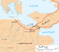
Isthmus of Corinth-ar.svg 672 × 600; 144 KB
-
Isthmus of Corinth-es.svg 672 × 600; 250 KB
-
Isthmus of Corinth.svg 672 × 600; 117 KB
-
Locatie Golf van Egina.PNG 478 × 365; 14 KB
-
Megara Gulf.jpg 902 × 495; 76 KB
-
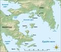
Saronic Gulf map-de.svg 1,490 × 1,280; 808 KB
-
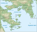
Saronic Gulf map-es.svg 1,490 × 1,280; 921 KB
-
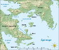
Saronic Gulf map-fr.svg 1,490 × 1,280; 808 KB
-
Saronic Gulf map-hr.pdf 2,483 × 2,133; 2.02 MB
-
Saronic Gulf map-hu.svg 1,490 × 1,280; 808 KB
-
Saronic Gulf map-la.svg 1,490 × 1,280; 801 KB
-
Saronic Gulf map-mk.svg 1,490 × 1,280; 883 KB
-
Saronic Gulf.png 200 × 204; 16 KB


