Category:Maps of the Salish Sea
Jump to navigation
Jump to search
Subcategories
This category has the following 3 subcategories, out of 3 total.
Media in category "Maps of the Salish Sea"
The following 24 files are in this category, out of 24 total.
-
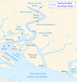
Burrard-Inlet-map-en.svg 1,259 × 904; 80 KB
-
Coast Salish language map.svg 512 × 648; 84 KB
-
Carte baie Desolation fr.png 1,425 × 882; 310 KB
-
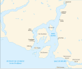
Carte baies Desolation et Bute.svg 959 × 909; 64 KB
-
Carte Iles Discovery.svg 1,888 × 924; 166 KB
-
Gulf Islands map 2 without border.png 801 × 871; 582 KB
-
Gulf Islands map 2.png 801 × 871; 594 KB
-
Carte baie Howe.svg 1,093 × 921; 94 KB
-
Carte simplifiée baie Jervis.svg 826 × 882; 128 KB
-
Juan de Fuca unmarked without border ja.png 604 × 411; 499 KB
-
Juan de Fuca unmarked without border.png 604 × 411; 500 KB
-
Juan de Fuca unmarked.png 604 × 411; 514 KB
-
Ocean Networks Canada Installations in the Salish Sea.jpg 1,657 × 936; 4.27 MB
-
Salish feet without border.png 1,622 × 2,306; 1.17 MB
-
Salish feet.jpg 2,400 × 3,200; 2.6 MB
-
Salish feet.png 1,622 × 2,306; 1.51 MB
-
San Juan Islands map without border.png 784 × 861; 541 KB
-
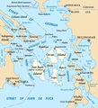
San Juan Islands map.png 784 × 861; 504 KB
-
Sea to Sky Highway en.svg 1,097 × 923; 131 KB
-
Sea to Sky Highway.svg 1,097 × 923; 131 KB
-
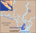
Locmap-SutilChannel.png 296 × 273; 34 KB
-
Web pdfs odd pink.pdf 1,275 × 1,650; 1.08 MB
-
Web pdfs ps chum.pdf 1,275 × 1,650; 1.14 MB
-
Web pdfs ps coho.pdf 1,275 × 1,650; 1.1 MB


