Category:Maps of the Republic of Artsakh
Jump to navigation
Jump to search
Wikimedia category | |||||
| Upload media | |||||
| Instance of | |||||
|---|---|---|---|---|---|
| Category combines topics | |||||
| Republic of Artsakh | |||||
former de-facto state in South Caucasus from 1992 to 2024, government-in-exile since 2024   .svg) | |||||
| Pronunciation audio | |||||
| Instance of |
| ||||
| Name in native language |
| ||||
| Location | Caucasus, Caucasus Mountains | ||||
| Capital | |||||
| Basic form of government | |||||
| Legislative body | |||||
| Official language | |||||
| Anthem |
| ||||
| Currency | |||||
| Head of state |
| ||||
| Head of government | |||||
| Inception |
| ||||
| Significant event | |||||
| Population |
| ||||
| Area |
| ||||
| Different from | |||||
 | |||||
Subcategories
This category has the following 8 subcategories, out of 8 total.
!
M
P
Pages in category "Maps of the Republic of Artsakh"
This category contains only the following page.
Media in category "Maps of the Republic of Artsakh"
The following 83 files are in this category, out of 83 total.
-
 1922-Wilsonian-Armenia-and-the-Caucasus-Vintage~2.jpg 1,318 × 1,310; 1,010 KB
-
 2020 Karabagh Ceasefire.svg 1,875 × 1,271; 1,020 KB
-
 2020 Nagorno-Karabakh war map.png 10,394 × 8,220; 3.45 MB
-
 2020 Nagorno-Karabakh war Turkish.png 2,560 × 2,024; 889 KB
-
 Abkhazia Artsakh Locator.png 1,740 × 1,370; 338 KB
-
 Administrative divisions of the Republic of Artsakh 1994-2020.svg 1,320 × 1,600; 929 KB
-
 Ani Location Artsakh en.gif 595 × 387; 75 KB
-
 Armenia Artsakh Locator.png 1,740 × 1,370; 338 KB
-
 Armenia artsakh map.png 184 × 143; 17 KB
-
 ArmeniaMapArmenian+.jpg 800 × 558; 255 KB
-
 Artsakh Azerbaijan Locator.png 1,740 × 1,370; 338 KB
-
 Artsakh CIA map PL.png 1,859 × 1,688; 1.03 MB
-
 Artsakh Clashes April 2016 GIF.gif 1,200 × 1,093; 589 KB
-
 Artsakh Current en.png 595 × 387; 60 KB
-
 Artsakh Karabakh Regions.png 109 × 179; 16 KB
-
 Artsakh line of contact.png 2,000 × 1,528; 506 KB
-
 Artsakh map in Armenian.jpg 1,680 × 1,196; 397 KB
-
 Artsakh Nagorno-Karabakh map in Edessan Aramaic (Syriac).jpg 1,660 × 1,080; 349 KB
-
 Artsakh Peru Locator.svg 2,560 × 1,134; 1.06 MB
-
 Artsakh Republic 1994-2020.svg 1,292 × 1,423; 2.03 MB
-
 Artsakh Russia Locator.png 1,740 × 1,370; 332 KB
-
 Artsakh South Ossetia Locator.png 1,740 × 1,370; 338 KB
-
 Artsakh stub.png 917 × 1,177; 78 KB
-
 Artsakh-Hillshaded-QGIS.png 3,100 × 2,480; 10.21 MB
-
 Artsakhpeace.png 750 × 595; 144 KB
-
 BergachtigK123.jpg 1,432 × 1,660; 172 KB
-
 Bergkarabachauseinandersetzung (Tekumzeola).png 595 × 387; 72 KB
-
 Caucasus breakaway regions 2008 mk.svg 3,000 × 2,150; 1.08 MB
-
 Caucasus breakaway regions 2008.svg 3,000 × 2,150; 1.1 MB
-
 Caucasus Political.png 10,299 × 7,807; 5.87 MB
-
 COVID-19 Outbreak Cases in Artsakh (Density).svg 1,169 × 1,198; 21 KB
-
 Flag map of Artsakh 2020.png 1,478 × 1,569; 129 KB
-
 Haut-Karabakh 12 10 2020.jpg 2,003 × 1,384; 605 KB
-
 Karabach-Kaart.jpg 1,859 × 1,688; 376 KB
-
 Karabakh war 2020 de.png 2,821 × 2,715; 8.34 MB
-
 Karabakh war 2020 topo map en.png 2,821 × 2,715; 8.36 MB
-
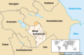
 Karabakh-regions-map.jpg 720 × 720; 94 KB
-
 KAUKASUSLÄNDER(CAUCASIAN COUNTRIES,СТРАНЫ КАВКАЗА).jpg 1,394 × 906; 679 KB
-
 Khamsa - Melikdoms of Karabakh 17th–19th century ad.png 620 × 428; 18 KB
-
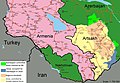
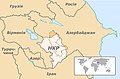
 Location map of Armenia with Artsakh.png 1,160 × 1,190; 275 KB
-
 Location map of Artsakh and surrounding territories.jpg 1,750 × 2,010; 383 KB
-
 Madrid Principles.png 2,000 × 1,584; 90 KB
-
 Map of Community for Democracy and Rights of Nations.png 655 × 600; 244 KB
-

-
 MapOfArtsakh2021.png 800 × 881; 21 KB
-
 Meghri Proposal.png 826 × 838; 45 KB
-
 Miatsum.png 2,916 × 2,322; 1.13 MB
-
 Nagorno Karabakh Current ka.png 595 × 387; 46 KB
-
 Nagorno-Karabakh conflict map (pre-2020).png 1,000 × 500; 130 KB
-
 Nagorno-Karabakh ethnic map (1995).png 346 × 329; 57 KB
-
 Nagorno-Karabakh region.png 109 × 127; 4 KB
-
 Nagorno-Karabakh regions map.png 2,897 × 3,005; 905 KB
-
 Nagorno-Karabakh regions map.svg 744 × 1,052; 877 KB
-
 Nagorno-Karabakh war map (2020) (vi).svg 667 × 462; 897 KB
-
 Nagorno-Karabakh war map (2020).svg 667 × 462; 972 KB
-
 Nakhichevan and Artsakh in Azerbaijan location map.png 1,000 × 766; 198 KB
-
 Nkr.gif 480 × 312; 52 KB
-
 Qarabagh War Map (2020-11-10).svg 668 × 462; 898 KB
-
 QarabaghWarMap(2020).jpg 1,856 × 1,282; 454 KB
-
 RA+Artsakh-Hillshaded-QGIS.png 3,100 × 2,480; 13.49 MB
-

-
 Republic of Artsakh map woAzeri.png 906 × 1,154; 34 KB
-
 Republic of Artsakh map.png 906 × 1,209; 56 KB
-
 Rivers of Armenia and Artsakh.png 1,708 × 1,374; 946 KB
-
 Shaumyan n Getashen EN.png 693 × 536; 22 KB
-
 Shaumyan n Getashen.png 678 × 639; 27 KB
-
 Stepanakert – Museum of Fallen Soldiers 6.jpg 5,184 × 3,456; 6.87 MB
-
 TekumzeolaBergkarabachauseinandersetzung.png 595 × 387; 67 KB
-
 Territorial changes after 2016 Armenian-Azerbaijani clashes.jpg 937 × 1,077; 206 KB
-
 Territorial changes after 2016 Armenian-Azerbaijani clashes.PNG 656 × 757; 446 KB
-
 Topo map Artsakh en.png 2,999 × 2,715; 8.63 MB
-
 Topo map Arzach de.png 2,999 × 2,715; 8.69 MB
-
 US States Recognition of Artsakh.svg 959 × 593; 42 KB
-
 Visa requirements for the citizens of the Republic of Artsakh (Nagorno-Karabakh).png 7,175 × 3,201; 2.19 MB
-
 НКР.jpg 592 × 388; 140 KB
-

-
 Արցախի Հանրապետության վարչատարածքային բաժանում.svg 1,320 × 1,600; 54 KB
-
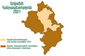 Արցախի Հանրապետության քարտեզ 2021.png 960 × 640; 90 KB
-
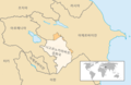
 Լեռնային Ղարաբաղի Հանրապետությունը Հարավային Կովկասում.png 1,053 × 694; 179 KB
-
 Հայաստանի Հանրապետություն և ԼՂՀ.png 517 × 421; 42 KB
-
 ՀՀ և ԼՂՀ քարտեզ.png 1,200 × 986; 194 KB
-
 Ջաբրայիլը Անդրկովկասում (hy).png 601 × 403; 118 KB
-
 현재의 나고르노카라바흐.png 595 × 387; 55 KB


.jpg)


.png)


.svg)


.jpg)


.png)
.png)


_(vi).svg)
.svg)


.svg)
.jpg)


.png)

.jpg)


.png)
