Category:Maps of the Portuguese Empire
Jump to navigation
Jump to search
Subcategories
This category has the following 3 subcategories, out of 3 total.
!
C
P
Pages in category "Maps of the Portuguese Empire"
The following 2 pages are in this category, out of 2 total.
Media in category "Maps of the Portuguese Empire"
The following 63 files are in this category, out of 63 total.
-
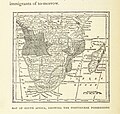
122 of 'White Man's Africa ... Illustrated by R. C. Woodville, etc' (11294761843).jpg 1,309 × 1,247; 545 KB
-
All areas of the world that were once part of the Portuguese Empire V01.png 1,425 × 625; 79 KB
-
All areas of the world that were once part of the Portuguese Empire.png 1,425 × 629; 38 KB
-
Custom Flag map of the Portuguese Empire.png 1,260 × 549; 45 KB
-
Descobrimentos e explorações portuguesesV2.png 1,357 × 628; 211 KB
-
Diachronic map of the Portuguese Empire (1415-1999).png 1,425 × 625; 21 KB
-
Diachronic map of the Spanish Empire 2.svg 863 × 443; 6.05 MB
-
Diachronic map of the Spanish Empire-zh-hans.svg 4,371 × 2,284; 6.42 MB
-
Diachronic map of the Spanish Empire.svg 4,371 × 2,284; 6.47 MB
-
Dutch-Port War Result.PNG 2,753 × 1,400; 154 KB
-
España y Portugal.png 1,500 × 770; 254 KB
-
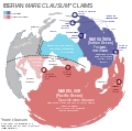
Iberian mare clausum claims.svg 1,600 × 956; 269 KB
-
Iberian Union Empires.png 1,357 × 628; 25 KB
-
Iberian Union empires.svg 940 × 415; 1.83 MB
-
IberianMareClausum-es.svg 613 × 608; 835 KB
-
IberianMareClausum.svg 875 × 869; 203 KB
-
Imperio Español Completo de.svg 863 × 443; 6.58 MB
-
Imperio Español Completo-ar.svg 921 × 472; 6.39 MB
-
Imperio español diacrónico (es).svg 2,753 × 1,399; 1.01 MB
-
Imperio español version completa.png 2,752 × 1,397; 279 KB
-
ImperioportuguesinicioXIX.png 1,356 × 627; 26 KB
-
Imperios Español y Portugués 1790.svg 2,655 × 3,000; 7.7 MB
-
Imperios ibéricos, 1790.svg 2,754 × 1,398; 1.53 MB
-
Karte Portugiesisch-Spanischer Verträge.png 1,500 × 775; 180 KB
-
Kolonialreich portugal klein.jpg 1,719 × 958; 374 KB
-
Linie Inter Caetera und Tordesillas.jpg 1,200 × 1,254; 103 KB
-
Paquistão P011.jpg 2,365 × 1,763; 994 KB
-
PDW.png 1,357 × 628; 315 KB
-
Philip II's realms in 1598.png 2,560 × 1,303; 380 KB
-
Portugal 1916-1974.png 1,262 × 624; 58 KB
-
Portugal and Environs 1415-ar.png 350 × 203; 21 KB
-
Portugal and Environs 1415.png 350 × 203; 19 KB
-
Portugal Império total.png 1,425 × 625; 29 KB
-
Portugal-1500.png 1,357 × 628; 72 KB
-
Portugiesische Gewürzroute.png 1,200 × 739; 201 KB
-
Portuguese Agora F14.png 1,771 × 1,002; 2.06 MB
-
Portuguese Angola, c. 1500-1800.svg 3,804 × 2,776; 2.95 MB
-
Portuguese colonial war-eo.png 537 × 600; 51 KB
-
Portuguese discoveries and explorationsV3en.png 1,357 × 628; 244 KB
-
Portuguese empire 1800.png 1,356 × 627; 41 KB
-
Portuguese empire 1800.svg 1,000 × 500; 1.3 MB
-
Portuguese Empire 20th century.png 1,425 × 625; 44 KB
-
Portuguese Empire map.jpg 1,357 × 628; 140 KB
-
Portuguese Empire V37.png 1,023 × 993; 158 KB
-
Portuguese empire VPT.png 1,425 × 625; 38 KB
-
PortugueseColonialEmpire.png 6,460 × 3,403; 1.47 MB
-
PortugueseColonialEmpire02.png 6,460 × 3,403; 1.48 MB
-
Segunda Unión Ibérica.svg 2,754 × 1,398; 4.61 MB
-
Size of Empires.svg 996 × 1,515; 2.57 MB
-
Southeast Asia Portuguese Empire 1.png 1,600 × 1,060; 1.93 MB
-
Southeast Asia Portuguese Empire.png 1,600 × 1,060; 1.93 MB
-
Spain and Portugal-ar.png 1,500 × 771; 225 KB
-
Spain and Portugal-fr.png 1,500 × 771; 188 KB
-
Spain and Portugal.png 1,500 × 771; 92 KB
-
Spanish Empire Anachronous en IncludingClaims.svg 2,753 × 1,399; 1.17 MB
-
Spanish Empire Anachronous en.svg 2,753 × 1,399; 1.12 MB
-
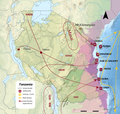
Tanzania Portuguese 8.png 1,024 × 975; 884 KB
-
V02.png 1,425 × 625; 101 KB
-
V03.png 1,425 × 625; 96 KB
-
V05.png 1,425 × 625; 36 KB
-
V07.png 1,425 × 625; 38 KB
-
World Map of the Portuguese Colonies-cs.png 7,620 × 4,167; 2.87 MB
-
מפת חוזה סרגוסה.svg 1,219 × 627; 643 KB


