Category:Maps of the Ottoman Empire in the 14th century
Jump to navigation
Jump to search
English: This category is about history maps on the subject. Contemporary, old maps belong into: Category:14th-century maps of the Ottoman Empire and its subcategories.
Maps of the Ottoman Empire by century: (BCE) (CE) 13th century · 14th century · 15th century · 16th century · 17th century · 18th century · 19th century · 20th century ·
Subcategories
This category has only the following subcategory.
Media in category "Maps of the Ottoman Empire in the 14th century"
The following 46 files are in this category, out of 46 total.
-
1328 Mediterranean Sea.PNG 801 × 370; 139 KB
-
C. 1330 Western Asia under Mongols.jpg 3,993 × 3,000; 3.93 MB
-
South East Europe 1340.gif 1,113 × 854; 363 KB
-
1350 Mediterranean Sea.PNG 801 × 370; 135 KB
-
Byzantine empire 1355.jpg 1,134 × 897; 380 KB
-
Byzantine Empire 1355.jpg 743 × 600; 411 KB
-
C. 1355 Southeastern Europe.jpg 1,690 × 1,335; 1.37 MB
-
MediterráneoOrientalEn1389-es.svg 2,218 × 1,468; 1.29 MB
-
1389 Mediterranean Sea-es.svg 925 × 424; 119 KB
-
1389 Mediterranean Sea-hu.svg 925 × 424; 119 KB
-
1389 Mediterranean Sea-pt.svg 925 × 424; 119 KB
-
1389 Mediterranean Sea.PNG 801 × 370; 133 KB
-
3 -Murad I map-ar.png 892 × 710; 72 KB
-
3 -Murad I map-es.svg 768 × 669; 472 KB
-
3 -Murad I map-pt.svg 768 × 669; 355 KB
-
3 -Murad I map.PNG 892 × 710; 59 KB
-
Anatolian Beyliks in 1300-es.svg 765 × 518; 527 KB
-
Balkans between 1265 & 1355.jpg 736 × 1,657; 1.34 MB
-
Byzantine empire 1355V2Make.svg 5,924 × 3,211; 629 KB
-
Carte du Moyen-Orient en 1328-hu.svg 1,349 × 909; 414 KB
-
DominiosDeOrhánI-pt.svg 735 × 473; 50 KB
-
DominiosDeOrhánI.svg 735 × 473; 385 KB
-
Empire byzantin 1389.PNG 605 × 362; 87 KB
-
Empèri Otoman - Expansion territòriala de 1307 a 1490-es.svg 1,035 × 865; 1.25 MB
-
Empèri Otoman - Expansion territòriala de 1307 a 1490-pt.svg 1,035 × 865; 562 KB
-
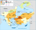
Empèri Otoman - Expansion territòriala de 1307 a 1490.png 1,698 × 1,569; 718 KB
-
Empèri Otoman - Expansion territòriala de 1307 a 1683.png 1,652 × 1,170; 778 KB
-
Mediterranean1400.png 1,215 × 549; 187 KB
-
Orhan I area map-ar.png 2,022 × 1,413; 503 KB
-
Orhan I area map-es.svg 1,444 × 853; 301 KB
-
Orhan I area map-ru.svg 489 × 288; 110 KB
-
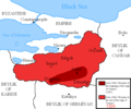
Orhan I area map.png 2,388 × 1,668; 696 KB
-
Osman I area map (cropped).PNG 749 × 528; 17 KB
-
Osman I area map-ar.png 816 × 683; 82 KB
-
Osman I area map.PNG 816 × 680; 63 KB
-
Ottoman empire in 1389 and in 1396.png 2,459 × 1,365; 879 KB
-
South-eastern Europe 1354-1358-es.svg 2,086 × 1,483; 2.53 MB
-
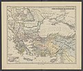
Spruner-Menke Handatlas 1880 Karte 88.jpg 3,504 × 2,947; 1.05 MB
-
Territorial changes of the Ottoman Empire 1300.jpg 1,104 × 834; 387 KB
-
Territorial changes of the Ottoman Empire 1359.jpg 1,104 × 834; 386 KB
-
Yildirim-Beyazid-dönemi-ar.jpg 543 × 336; 93 KB
-
Yildirim-Beyazid-dönemi-ar.svg 511 × 317; 800 KB
-
Yildirim-Beyazid-dönemi.jpg 543 × 336; 44 KB
-
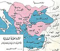
الدولة العثمانية في القرنين الرابع عشر والخامس عشر الميلاديين.jpg 1,003 × 851; 367 KB
-
ميلاد الدولة العثمانية وتوسعها حتى نهاية عهد سليم الأول.jpg 1,304 × 972; 404 KB


