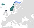
Category:Maps of the Norwegian Empire
Jump to navigation
Jump to search
Media in category "Maps of the Norwegian Empire"
The following 12 files are in this category, out of 12 total.
-
KingdomOfNorway(872-1397).jpg 3,840 × 1,935; 749 KB
-
Norgesveldet kart, uten Grønland.png 696 × 480; 31 KB
-
Norway About 1265.png 1,219 × 659; 26 KB
-
Norway1265.png 1,219 × 659; 38 KB
-
Norway1300.png 1,316 × 792; 40 KB
-
Norwegian expansion 780-1380.jpg 1,500 × 714; 461 KB
-
Norwegian expansion 800-1380.jpg 1,486 × 714; 262 KB
-
Norwegian Hereditary Empire excluding Greenland.png 1,200 × 1,000; 31 KB
-
Norwegian realm map, 1263.png 999 × 382; 114 KB
-
Norwegian.colonial.empire.jpg 1,365 × 974; 279 KB
-
ממלכת נורווגיה 1293.jpg 1,194 × 988; 89 KB
-
ממלכת נורווגיה בשנת 1263.jpg 1,200 × 1,000; 41 KB


