Category:Maps of the North Sea
Jump to navigation
Jump to search
Subcategories
This category has the following 11 subcategories, out of 11 total.
D
- De Nordseeküste (Karten) (15 F)
G
J
- Maps of Jadebusen (19 F)
K
M
- Maps of the Strait of Dover (23 F)
S
W
Media in category "Maps of the North Sea"
The following 166 files are in this category, out of 166 total.
-
North Sea map-de.png 2,472 × 3,104; 4.03 MB
-
North Sea map-en.png 2,475 × 3,100; 3.8 MB
-
North Sea map-fi.png 2,475 × 3,100; 3.84 MB
-
Locatie Noordzee.PNG 649 × 475; 20 KB
-
Admiralty Chart No 1504 Cromer to Harwich, Published 1962.jpg 11,273 × 13,645; 42.34 MB
-
Action of 28 January 1945 map.jpg 279 × 231; 25 KB
-
Admiralty Chart Catalogue 1967 Page 019 Index B2.jpg 8,568 × 6,809; 9.47 MB
-
Admiralty Chart Catalogue 1967 Page 024 Index D.jpg 8,595 × 6,929; 9.32 MB
-
Admiralty Chart No 1089 Orfordness to Blakeney, Published 1941.jpg 11,057 × 18,355; 54.16 MB
-
Admiralty Chart No 110 Hook of Schouwen to Westkapelle, Published 1968.jpg 16,380 × 11,277; 38.62 MB
-
Admiralty Chart No 1170 Coquet Island to Whitby, Published 1968.jpg 11,269 × 16,419; 52.1 MB
-
Admiralty Chart No 1409 Montrose to Banff, Published 1957.jpg 16,424 × 11,342; 24.73 MB
-
Admiralty Chart No 1503 Wells to Haisborough, Published 1966.jpg 16,208 × 11,026; 44.6 MB
-
Admiralty Chart No 1610 North Foreland to Orfordness, Published 1933 Large Corrections 1947.jpg 13,567 × 11,258; 33.89 MB
-
Admiralty Chart No 1610 North Foreland to Orfordness, Published 1953.jpg 16,395 × 11,326; 43.18 MB
-
Admiralty Chart No 1872 Dunkerque to Flushing, Published 1962, Large Corrections 1972.jpg 16,485 × 11,256; 11.02 MB
-
Admiralty Chart No 2182c North Sea Northern Sheet Published 1915.jpg 12,118 × 7,374; 5.57 MB
-
Admiralty Chart No 2339 North Sea, Published 1913.jpg 11,086 × 16,185; 68.99 MB
-
Amfidromieen.JPG 300 × 346; 114 KB
-
Amfidromieën.jpg 300 × 346; 608 KB
-
AtollenNoordzee-schetsen-JonKristinsson.pdf 1,239 × 1,752, 5 pages; 1.63 MB
-
Backsteingotik Nordsee0tx.png 3,002 × 2,124; 5.69 MB
-
Beef Run Sinking of 3 Destroyers December 23 1917.jpg 654 × 671; 107 KB
-
Belgische kustlijn met namen.png 567 × 340; 60 KB
-
Belgische kustlijn.png 567 × 340; 42 KB
-
Belgische Nordseeküste de.png 1,200 × 787; 914 KB
-
Belgische Nordseeküste en.png 1,200 × 787; 914 KB
-
Belgische Nordseeküste fr.png 1,200 × 787; 913 KB
-
Belgische Nordseeküste nl.png 1,200 × 787; 915 KB
-
Blocksnethcontplat.jpg 547 × 908; 199 KB
-
Brent crude oil map.png 3,300 × 2,550; 243 KB
-
Brent oilfield.jpg 383 × 393; 99 KB
-
Cable route picture.png 1,346 × 811; 191 KB
-
Carte de la mer du Nord.png 777 × 1,043; 185 KB
-
Carte des courants de la Manche et de la Mer du Nord.jpg 2,745 × 3,590; 752 KB
-
Cockley Cley, Norfolk, location.jpg 700 × 605; 194 KB
-
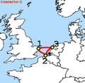
Concerto-1-Map.png 434 × 428; 76 KB
-
Die Britischen Inseln und die Nord-See.jpg 5,624 × 4,562; 7.85 MB
-
Die Gartenlaube (1896) b 0698 2.jpg 705 × 1,629; 76 KB
-
Doggerbank.jpg 1,300 × 1,700; 373 KB
-
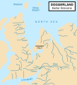
Doggerland-cy.svg 545 × 600; 122 KB
-
Doggerland.svg 545 × 600; 165 KB
-
Dunkirk Evacuation shipping routes.png 1,000 × 751; 182 KB
-
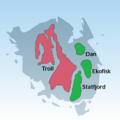
Dänenausbreitung.png 683 × 786; 778 KB
-
Détrtoit de Fram par Terres du Passé.png 1,924 × 1,084; 1.79 MB
-
EB1922 - Minesweeping And Minelaying Fig 1.png 1,061 × 879; 65 KB
-
Ziemeljura tekt.gif 1,200 × 977; 124 KB
-
EurogeulMaasgeulRotterdam.png 567 × 178; 6 KB
-
Forties.png 640 × 400; 20 KB
-
Fortlocations.gif 300 × 299; 19 KB
-
FreeAirNorthSea.svg 744 × 1,053; 621 KB
-
Fyn og oliefelter.png 764 × 762; 65 KB
-
Geopark-Vestjylland-outline.png 877 × 626; 777 KB
-
Gotischer Backstein Nordsee & westl. Ostsee.png 3,173 × 2,243; 6.94 MB
-
Gotischer Backstein um Nord- & südliche Ostsee.png 5,248 × 2,250; 11.33 MB
-
HanseVitalien.png 1,600 × 855; 949 KB
-
Helgolaender Bucht.jpg 879 × 700; 52 KB
-
HelicopterCrashSite.jpg 280 × 374; 36 KB
-
Heligoland Bight.jpg 800 × 800; 123 KB
-
IJgeul-Amsterdam.png 1,086 × 369; 18 KB
-
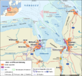
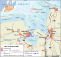
Jade-weser-muendung map de.png 800 × 743; 415 KB
-
Jade-weser-muendung map de.svg 1,483 × 1,377; 617 KB
-
KAARTEN SGD - Waterkwaliteitsplan Noordzee.jpeg 1,084 × 1,581; 187 KB
-
Kart rorledning lite.gif 300 × 306; 22 KB
-
Karte Brent-Ölfeld.png 1,405 × 1,209; 203 KB
-
Karte Europäisches Nordmeer.png 1,000 × 913; 291 KB
-
Karte Naturschutzgebiete in der deutschen ausschließlichen Wirtschaftszone.svg 1,755 × 728; 229 KB
-
Karte Nord- und Ostsee.png 800 × 854; 195 KB
-
Karte Offshore-Windkraftanlagen in der Deutschen Bucht.png 4,342 × 3,483; 2.61 MB
-
Karte Offshore-Windparks in der Deutschen Bucht.svg 4,181 × 2,987; 1.84 MB
-
Karte-verkehrszentralen-wsv.png 1,575 × 790; 1.43 MB
-
Karte-verkehrszentralen-wsv.svg 1,575 × 790; 2.03 MB
-
Carte Skagerrak-Kattegat2.png 445 × 508; 15 KB
-
Kattegat.png 649 × 475; 7 KB
-
Locatie Kattegat.PNG 649 × 475; 20 KB
-
Late Medieval Trade Routes.jpg 1,457 × 1,088; 372 KB
-
Ziemeljura.jpg 2,284 × 2,990; 4.14 MB
-
Locatie Noordzee -none-.PNG 649 × 475; 9 KB
-
Locatie Noordzee arp.png 649 × 475; 12 KB
-
Locatie Zuidelijke Bocht.PNG 649 × 475; 15 KB
-
Locatie-K12-B.gif 245 × 445; 4 KB
-
Map - Kingdom of the Isles 2 (svg).svg 511 × 637; 1.63 MB
-
Map Doggerbank 1867.jpg 910 × 1,246; 215 KB
-
Map of the English Channel and coasts.png 1,000 × 751; 168 KB
-
Map of the offshore wind power farms in the German Bight.png 4,342 × 3,483; 2.6 MB
-
Map Offshore Windfarms in the German Bight.svg 4,181 × 2,987; 1.84 MB
-
Mer du Nord-vierge.png 1,076 × 1,217; 96 KB
-
Mor Keltek Libelys.png 1,058 × 1,188; 161 KB
-
N.C.P. Blokindeling - Topografische kaarten - 30033391 - RCE.jpg 6,644 × 9,518; 2.81 MB
-
Natura2000 North Sea NL.svg 500 × 800; 36 KB
-
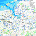
Nedereems.png 2,085 × 2,085; 2.02 MB
-
NoordzeeScheepvaartroutes.png 850 × 600; 24 KB
-
Nordsee EN-B-DK.png 3,742 × 2,503; 1.7 MB
-
Nordsee Wirtschaftszonen.png 619 × 720; 342 KB
-
Nordsøens fund.png 854 × 1,044; 282 KB
-
Norskerenna.png 618 × 800; 38 KB
-
North Sea Continental Shelf Cases.svg 988 × 1,159; 601 KB
-
North Sea Currents.svg 988 × 1,159; 453 KB
-
North sea eez.PNG 1,034 × 1,200; 128 KB
-
North Sea Fields Zoom north.jpg 838 × 586; 98 KB
-
North Sea in its region.svg 500 × 281; 4.83 MB
-
North sea languages 900.png 348 × 514; 7 KB
-
North Sea location map.svg 988 × 1,159; 582 KB
-
North Sea Network location map.jpg 988 × 1,159; 405 KB
-
North Sea oil and gas fields.svg 630 × 873; 715 KB
-
North Sea OilandGas Fields.jpg 401 × 539; 69 KB
-
North Sea relief location map.jpg 988 × 1,159; 909 KB
-
North Sea.jpg 1,300 × 1,700; 1.27 MB
-
North-Sea-Labels-3.jpg 1,220 × 1,678; 2.12 MB
-
North-Sea-Labels-5.jpg 1,220 × 1,678; 2.07 MB
-
North-Sea-Labels.jpg 1,300 × 1,700; 1.39 MB
-
North-Sea.jpg 458 × 599; 208 KB
-
North.Sea.Periphery.250.500.jpg 2,031 × 2,463; 820 KB
-
NorthSea395AD.jpg 684 × 775; 368 KB
-
NorthSeaCurrents.jpg 1,300 × 1,700; 1.02 MB
-
NorthSeaCurrents.png 1,300 × 1,700; 3.43 MB
-
Norveško more.svg 1,000 × 913; 492 KB
-
Norvég-tenger térkép 2.png 1,000 × 913; 416 KB
-
Norwegian Sea map ce.svg 857 × 783; 473 KB
-
Norwegian Sea map cs.png 1,000 × 913; 414 KB
-
Norwegian Sea map hr.svg 857 × 783; 533 KB
-
Norwegian Sea map it.png 1,000 × 913; 413 KB
-
Norwegian Sea map mk.svg 857 × 783; 483 KB
-
Norwegian Sea map no.png 1,000 × 913; 406 KB
-
Norwegian Sea map ru.svg 857 × 783; 574 KB
-
Norwegian Sea map sv.png 1,000 × 913; 360 KB
-
Norwegian Sea map.png 1,000 × 913; 513 KB
-
Nseamap.gif 280 × 374; 43 KB
-
Pascaart van de Noort zee (NYPL b13908778-1619022).jpg 5,528 × 4,567; 6.59 MB
-
OD Kontinentalsokkelkart 2016.pdf 5,075 × 6,735; 5.92 MB
-
ODIN-Map.png 228 × 288; 13 KB
-
OpenSeaMap-ChartBundleArea-NorthSea-2016-05.png 524 × 497; 115 KB
-
Operational Navigation Chart D-2, 7th edition.jpg 9,254 × 6,633; 17.41 MB
-
Ostfriesische Inseln (Karte).png 13,425 × 5,135; 6.04 MB
-
PlanHerbstreise.jpg 704 × 904; 121 KB
-
Shipping Zones.png 295 × 378; 11 KB
-
Sillkarta.jpg 753 × 675; 315 KB
-
Silverpit crater location.jpg 374 × 368; 67 KB
-
Karte Skagerrak.png 940 × 1,123; 234 KB
-
Strait of Dover map hr.svg 857 × 643; 461 KB
-
Strait of Dover map mk.svg 857 × 643; 487 KB
-
Territòris de Cnut lo Grand.png 722 × 665; 134 KB
-
The Wreck of the Cantabria.JPG 1,212 × 1,518; 121 KB
-
Thorntonbank.png 550 × 460; 27 KB
-
Tiden Loc.jpg 986 × 911; 570 KB
-
Tiden loc.png 2,231 × 3,203; 323 KB
-
Tidenems map.png 1,662 × 1,776; 1.14 MB
-
Tidenems.png 2,085 × 2,085; 2.03 MB
-
Transgression marine rive Est de la Mer du Nord (de 250 à 600).jpg 600 × 389; 26 KB
-
Tryggve Gran Flug 3 (cropped).jpg 510 × 567; 214 KB
-
Tryggve Gran Flug 3.jpg 611 × 799; 381 KB
-
UK shipping forecast zones.png 960 × 1,280; 257 KB
-
Utsira Formation 01.png 516 × 508; 179 KB
-
VitalienbruederNordsee.png 1,633 × 1,622; 1.19 MB
-
Wasserscheide Nordsee Ostsee.PNG 1,200 × 1,184; 528 KB
-
Landgebiete der Freien Stadt Bremen.png 918 × 1,316; 76 KB
-
Zeebrugge-Heist-Lichtlijn.png 394 × 389; 9 KB


