Category:Maps of the North Pole
Jump to navigation
Jump to search
Subcategories
This category has only the following subcategory.
Media in category "Maps of the North Pole"
The following 73 files are in this category, out of 73 total.
-
121 of 'Out with the Olde Voyagers' (11302841264).jpg 1,251 × 1,422; 554 KB
-
124 of 'Advanced Geography' (11290575705).jpg 753 × 1,501; 297 KB
-
1598 map of the Polar Regions by Willem Barentsz.jpg 13,719 × 10,160; 30.66 MB
-
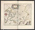
"Regiones sub Polo Arctico - Auctore Guiljelmo Blaeu." (22269330921).jpg 3,838 × 3,023; 2.09 MB
-
1799 Clement Cruttwell Map of North Pole - Geographicus - NorthPole-cruttwell-1799.jpg 3,500 × 3,289; 2.71 MB
-
1855 Colton Map of the Arctic or North Pole - Geographicus - NorthernRegions-colton-1855.jpg 3,314 × 4,000; 4.26 MB
-
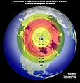
22 Aurora Viewing Location Map (2849896588).jpg 1,040 × 1,090; 489 KB
-
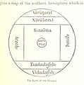
306 of 'Eclectic Physical Geography' (11200785145).jpg 1,315 × 2,066; 686 KB
-
A map of the countries thirty degrees round the North Pole (12619164183).jpg 2,000 × 2,000; 1.28 MB
-
A Map of the North Pole and the Parts Adioining, Oxon, 1680.jpg 1,920 × 1,500; 1.34 MB
-
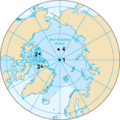
Arctic Ocean CIA map - koi.png 329 × 330; 36 KB
-
Barents third voyage.jpg 2,000 × 1,511; 965 KB
-
Barentskartet, 1598 (12068020364).jpg 2,842 × 2,091; 3.85 MB
-
Barentsz arctic map.jpg 650 × 517; 102 KB
-
Barentsz Full Map.jpg 1,000 × 742; 258 KB
-
Bennike-2011-side4.png 989 × 846; 134 KB
-
Brockhaus and Efron Encyclopedic Dictionary b48 482-0.jpg 2,186 × 1,925; 1.67 MB
-
ChandlerWobble.jpg 1,607 × 1,632; 716 KB
-
Democratic Ideals and Reality, 1919 Fig 14 p 94.jpg 874 × 788; 69 KB
-
Die Gartenlaube (1883) b 345.jpg 1,839 × 2,751; 3.6 MB
-
EB1911 Polar Regions -North Polar Regions Isotherms.jpg 1,134 × 1,462; 629 KB
-
EB1911 Polar Regions -North Polar Regions.jpg 1,092 × 1,510; 648 KB
-
FMIB 39491 Map showing how the land clusters about the north pole.jpeg 1,003 × 711; 161 KB
-
FMIB 43941 Map showing treeless Regions around the North Pole.jpeg 882 × 912; 217 KB
-
FMIB 43980 Unexplored Regions of the Northern Polar Circle.jpeg 1,037 × 1,101; 303 KB
-
Forminsket utgave av Barentskartet - no-nb krt 00487.jpg 4,418 × 3,449; 3.45 MB
-
Iparpoloa.png 329 × 330; 45 KB
-
KAL Flight 902's flightplan.png 1,083 × 1,436; 391 KB
-
Laptev Sea map-el.svg 1,498 × 839; 310 KB
-
Liwot va vwardol.png 499 × 566; 164 KB
-
Loxodromie Gnomonique.png 1,247 × 838; 41 KB
-
Magnetic North Pole Positions 2015.svg 445 × 665; 808 KB
-
Magnetic North Pole Positions.svg 567 × 581; 470 KB
-
Magnetic Pole (PSF).png 2,800 × 1,644; 509 KB
-
Map of the North Polar Regions.jpg 2,640 × 1,778; 1.53 MB
-
Noordpool centraal vanuit ruimte bol canada centraal.PNG 743 × 733; 29 KB
-
Noordpool centraal vanuit ruimte bol europa centraal.PNG 752 × 754; 60 KB
-
Nordhalbkugel-polständige-Azimutalabbildung.PNG 1,110 × 1,113; 221 KB
-
Nordpole-it.png 329 × 330; 18 KB
-
Nordpole-ru.png 329 × 330; 37 KB
-
Nordpole.png 329 × 330; 12 KB
-
Northern Hemisphere LamAz-Colias palaeno.png 800 × 800; 66 KB
-
Ocean Arctic - Localizacion de l'Ila Banks.png 975 × 1,005; 484 KB
-
Ocean Arctic - Localizacion de l'Ila Victòria.png 975 × 1,005; 483 KB
-
Ocean Arctic - Topografia - Localizacion de la Mar dei Chokchis.png 975 × 1,005; 486 KB
-
Ocean Artic - Clima.png 1,059 × 1,062; 329 KB
-
Ocean Artic - Situation politica en 2021.png 1,099 × 1,127; 506 KB
-
Page 179 of Story of geographical discovery (Jacobs).png 1,260 × 2,372; 1.17 MB
-
Peary Arctic expedition 1908-1909.svg 554 × 936; 1.87 MB
-
Pohjoinen napapiiri ja arktinen alue.png 1,166 × 1,287; 1.05 MB
-
Pontanus 1611 Arctic Map.jpg 2,852 × 2,142; 802 KB
-
Review of reviews and world's work (1890) (14782230614).jpg 2,456 × 3,100; 1.14 MB
-
RR5117-0032R.gif 330 × 330; 90 KB
-
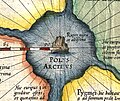
Rupes Nigra.jpg 564 × 477; 421 KB
-
Transpolar shipping routes.svg 553 × 553; 425 KB
-
Таяние паковых льдов в Арктике.png 5,760 × 5,196; 2.52 MB


