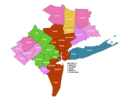
Category:Maps of the New York metropolitan area
Jump to navigation
Jump to search
Media in category "Maps of the New York metropolitan area"
The following 30 files are in this category, out of 30 total.
-
Esso-Happy motoring in New-York - btv1b531895719 (2 of 2).jpg 7,536 × 10,356; 13.96 MB
-
Map of the New York metropolitan area.svg 151 × 147; 195 KB
-
Map of the USA highlighting the New York metropolitan area.png 4,200 × 3,105; 1.3 MB
-
New York City and vicinity - Esso - btv1b53189616f (2 of 2).jpg 7,118 × 7,578; 9.59 MB
-
New York City Greater NY US street map.svg 6,012 × 5,888; 43.74 MB
-
New York Community Bank footprint 2010-05.png 1,131 × 918; 125 KB
-
New York Metropolian Statistical Area.png 4,800 × 3,040; 8.36 MB
-
New York Metropolitan Area Counties 2013.png 1,015 × 860; 47 KB
-
New York Metropolitan Area Counties Illustration.PNG 836 × 821; 25 KB
-
New York Metropolitan Area Counties.svg 740 × 760; 194 KB
-
New York metropolitan area map.png 431 × 420; 38 KB
-
New York Metropolitan Area.jpg 1,058 × 1,068; 438 KB
-
New York metropolitan area.PNG 310 × 246; 19 KB
-
New York urban area.png 500 × 375; 27 KB
-
New York, New York 1955 Yellow Book.jpg 800 × 833; 226 KB
-
NY Metro Area.png 2,560 × 1,621; 1.52 MB
-
NY Metro Divisions.png 836 × 821; 37 KB
-
NY Metropolitan Area.png 4,200 × 3,105; 2.72 MB
-
Province de New York en 4 Feuilles par Montrésor - btv1b53233121c.jpg 11,666 × 17,525; 36.62 MB
-
Regional Plan Association 31 County Area.png 656 × 698; 75 KB
-
USA New York Tri State NYC area.svg 512 × 324; 531 KB
-
USA NewYork Connecticut NewJersey location map ko.svg 1,300 × 700; 1.41 MB
-
USACE(NY-NJ)CoastalStormRiskReductionProjectsStudiesMap.tif 659 × 416; 281 KB


