Category:Maps of the Nabataeans
Jump to navigation
Jump to search
Media in category "Maps of the Nabataeans"
The following 20 files are in this category, out of 20 total.
-
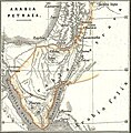
1865 Spruner Map of the Holy Land - Arabia petraea - Nabatean crop.jpg 613 × 623; 104 KB
-
Alter Orient 0001AD.svg 2,102 × 1,510; 5.05 MB
-
Alter Orient 0100AD.svg 2,102 × 1,510; 4.9 MB
-
Alter Orient 0100BC-es.svg 2,102 × 1,510; 3.84 MB
-
Alter Orient 0100BC.svg 2,102 × 1,510; 4.77 MB
-
Alter Orient 0200BC-es.svg 2,102 × 1,510; 3.64 MB
-
Alter Orient 0200BC.svg 2,102 × 1,510; 4.9 MB
-
Arabia Petraea.svg 2,180 × 1,600; 517 KB
-
Dictionnaire de la Bible I 205 carte de l Arabie.jpg 675 × 1,275; 263 KB
-
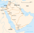
NABATAEAN TRADE ROUTES.png 886 × 727; 334 KB
-
Nabataeans in Palestine, 4-3 ct.jpg 766 × 958; 354 KB
-
Nabatean Kingdom (flat map).svg 672 × 442; 149 KB
-
Nabatean Kingdom map.jpg 1,200 × 1,417; 152 KB
-
Nabatean Kingdom.svg 167 × 126; 10 KB
-
NabateensRoutes-ar.png 837 × 814; 132 KB
-
NabateensRoutes.png 837 × 814; 56 KB
-
NabateensRoutesBlank.png 837 × 814; 93 KB
-
NabateensRoutesHe.png 837 × 814; 359 KB
-
Periplus Maris Erythraei World Map b29353051 0335.jpg 3,899 × 3,179; 1.85 MB
-
Periplus World Map.jpg 2,142 × 1,774; 785 KB


