Category:Maps of the Muisca Confederation
Jump to navigation
Jump to search
Media in category "Maps of the Muisca Confederation"
The following 13 files are in this category, out of 13 total.
-
Altiplano Cundiboyacense (subdivisions).png 1,740 × 1,600; 6.57 MB
-
Altiplano Cundiboyacense.png 1,740 × 1,600; 6.59 MB
-
Colombia MuiscaLocationMap.jpg 4,556 × 4,556; 7.22 MB
-
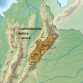
ConfederaciónMuisca.png 2,500 × 2,500; 1.45 MB
-
Conmuisca.webp 389 × 389; 220 KB
-
Conquest of Colombia.png 1,192 × 1,480; 2.31 MB
-
Map of Sierra Nevada de Santa Marta.png 1,456 × 1,376; 3.77 MB
-
Mapa del Territorio Muisca.svg 774 × 785; 269 KB
-
Mapa Imperio Muisca.PNG 1,000 × 1,320; 89 KB
-
Pueblos Muiscas del rincón de Saboyá.png 3,840 × 2,560; 3.66 MB
-
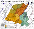
Pueblos Muiscas del Rincón de Vélez.jpg 2,522 × 2,160; 1.03 MB
-
Sabana de Bogota.png 1,068 × 902; 2.4 MB
-
Territorio dos muiscas.jpg 1,024 × 1,159; 187 KB


