Category:Maps of the Mexican War of Independence
Jump to navigation
Jump to search
Media in category "Maps of the Mexican War of Independence"
The following 34 files are in this category, out of 34 total.
-
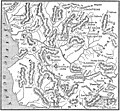
Actividad militar de Guerrero (1812-1817)-fr.svg 798 × 482; 404 KB
-
Actividad militar de Guerrero (1812-1817)-ru.svg 798 × 482; 120 KB
-
Actividad militar de Guerrero (1812-1817).svg 798 × 482; 424 KB
-
Campaña de Hidalgo.png 874 × 791; 1.04 MB
-
Campaña de Hidalgo.svg 664 × 664; 1.18 MB
-
HHBHM V4 D164 Plan of Alhondiga.jpg 1,873 × 1,189; 280 KB
-
HHBHM V4 D198 Hidalgo's march against Mexico.jpg 1,871 × 1,127; 479 KB
-
HHBHM V4 D201 Plan of Battlefield of Las Cruces.jpg 1,868 × 1,198; 564 KB
-
HHBHM V4 D223 Plan of battlefield at Aculco.jpg 1,893 × 1,114; 473 KB
-
HHBHM V4 D227 Intendencia of Guadalajara.jpg 1,875 × 1,740; 736 KB
-
HHBHM V4 D242 Plan of battlefield.jpg 1,900 × 2,343; 1.16 MB
-
HHBHM V4 D275 Battlefield of the bridge of Calderon.jpg 1,892 × 1,222; 311 KB
-
HHBHM V4 D291 Hidalgo's flight to Monclova.jpg 1,885 × 2,354; 551 KB
-
HHBHM V4 D322 Map of the western districts including Acapulco and Cuernavaca.jpg 1,957 × 1,135; 545 KB
-
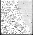
HHBHM V4 D364 Mexico's eastern districts.jpg 2,080 × 2,219; 902 KB
-
HHBHM V4 D372 Second campaing of Morelos.jpg 1,889 × 1,491; 457 KB
-
HHBHM V4 D386 Cuautla and vicinity.jpg 1,874 × 1,159; 485 KB
-
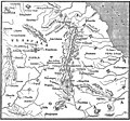
HHBHM V4 D409 Bajio of Guanajuato.jpg 1,883 × 1,524; 494 KB
-
HHBHM V4 D423 Puebla and southern Vera Cruz.jpg 1,878 × 1,760; 533 KB
-
HHBHM V4 D455 Seat of War.jpg 1,874 × 1,130; 443 KB
-
HHBHM V4 D459 Mizteca in Oajaca.jpg 1,895 × 1,439; 422 KB
-
HHBHM V4 D501 Campaigns in Puebla and Vera Cruz.jpg 1,899 × 1,741; 560 KB
-
HHBHM V4 D506 Oajaca province.jpg 1,901 × 1,371; 543 KB
-
HHBHM V4 D508 Plan of Oajaca.jpg 1,887 × 2,082; 995 KB
-
HHBHM V4 D533 Map of the revolution.jpg 1,855 × 1,679; 835 KB
-
HHBHM V4 D535 Operations in Michoacan.jpg 1,870 × 1,128; 435 KB
-
HHBHM V4 D552 Campaign in the east.jpg 2,074 × 2,221; 1,011 KB
-
HHBHM V4 D563 Chapala lake.jpg 1,891 × 1,391; 342 KB
-
HHBHM V4 D601 Province of Tecpan.jpg 1,946 × 1,132; 503 KB
-
HHBHM V4 D692 Mina's operations map.jpg 1,882 × 1,529; 446 KB
-
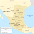
Resistencia insurgente en México 1814-1821.svg 2,657 × 1,666; 816 KB
-
Territorio insurgente 1813.svg 2,657 × 1,666; 591 KB
-
Кампания Идальго.svg 664 × 664; 266 KB


