Category:Maps of the Mentawai Islands
Jump to navigation
Jump to search
Media in category "Maps of the Mentawai Islands"
The following 11 files are in this category, out of 11 total.
-
Admiralty Chart No 864 The Passage between the Islands of Great Fortune, Published 1786.jpg 2,960 × 4,146; 2.07 MB
-
Forrest Chart Strait of Secockup, Mazular Island, Published 1782.jpg 3,288 × 4,184; 2.73 MB
-
ID - Mentawai.png 824 × 559; 27 KB
-
Mentawai Islands Map.png 1,360 × 1,566; 96 KB
-
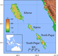
Mentawai Islands Topography.png 1,841 × 1,768; 1,017 KB
-
October 2010 Sumatra Earthquake.png 757 × 741; 379 KB
-
Sumatra 2007 earthquakes map.gif 505 × 496; 30 KB


