Category:Maps of the Maratha Confederacy
Jump to navigation
Jump to search
Subcategories
This category has only the following subcategory.
Media in category "Maps of the Maratha Confederacy"
The following 71 files are in this category, out of 71 total.
-
Battle of Pattankudi, 17 Sep 1799.jpg 1,481 × 2,272; 445 KB
-
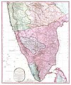
1800 Faden Rennell Wall Map of India - Geographicus - India-faden-1795.jpg 6,000 × 7,353; 10.85 MB
-
1800 Map of Peninsular India-1795.jpg 5,936 × 7,137; 50.39 MB
-
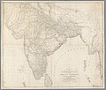
A map of Hindoostan, or the Mogul Empire, 1788.jpg 4,000 × 3,412; 2.71 MB
-
Battle of Moti Talao 8 Mar 1773.jpg 1,784 × 2,729; 357 KB
-
Battle of Sakhar Kherda 13 Oct 1724.jpg 1,353 × 1,942; 1.09 MB
-
Battle of Shakar Khera.jpg 1,518 × 1,631; 695 KB
-
Early Maratha History-Joppen.jpg 1,824 × 2,576; 1.37 MB
-
Hindoostan LOC 2009582749.jpg 9,772 × 10,507; 12.95 MB
-
Hindoostan LOC 2009582749.tif 9,772 × 10,507; 293.75 MB
-
Hindustan, 1803.jpg 1,827 × 1,543; 400 KB
-
India 1760-es.svg 2,151 × 2,546; 2.32 MB
-
India 1792 shepherd 1923.jpg 1,509 × 2,337; 2.4 MB
-
India in 1785.png 8,281 × 10,933; 1.08 MB
-
India in 1792.jpg 1,477 × 2,236; 3.62 MB
-
India in 1798.png 8,237 × 10,918; 954 KB
-
India in 1805.png 8,220 × 10,919; 876 KB
-
India map 1700 1792.jpg 1,477 × 2,158; 1.16 MB
-
Joppen1907India1795a.jpg 828 × 1,200; 287 KB
-
Joppen1907India1805a-21-es.svg 1,208 × 1,448; 2.78 MB
-
Joppen1907India1805a-21.jpg 843 × 1,200; 289 KB
-
Joppen1907India1805a.jpg 843 × 1,200; 230 KB
-
Joppenshivaji.jpg 822 × 1,538; 185 KB
-
Karta marathriket 1790.jpg 254 × 325; 17 KB
-
Larger map of marathas from "Historical Atlas of India," by Charles Joppen.jpg 1,255 × 1,824; 285 KB
-
Mahratta Country.jpg 1,804 × 2,812; 533 KB
-
Map of Afzalkhan campaign.jpg 856 × 602; 485 KB
-
Map of the Maratha Empire 1760.svg 1,486 × 1,734; 170 KB
-
Map showing places of Shivaji's campaigns.jpg 1,145 × 1,702; 371 KB
-
Map to illustrate Shahu's war against the Siddis of Janjira 1733-36.jpg 1,473 × 2,509; 589 KB
-
Maratha Confederacy.svg 1,639 × 1,852; 552 KB
-
Maratha Empire 1674 - 1818 ad (hy).png 429 × 600; 53 KB
-
Maratha Empire 1674 - 1818 ad.PNG 503 × 703; 10 KB
-
Maratha Empire 1680.PNG 500 × 590; 48 KB
-
Maratha Empire Flag Map.png 633 × 954; 42 KB
-
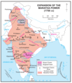
Maratha Empire in 1758.png 800 × 928; 381 KB
-
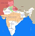
Maratha empire in 1759.jpg 720 × 680; 136 KB
-
Maratha Empire.png 359 × 443; 288 KB
-
Maratha Expansion under Shahu and Bajirao.jpg 1,692 × 2,241; 822 KB
-
Maratha-Empire-Facts.webp 640 × 325; 23 KB
-
MarathaEmpire1759.png 602 × 643; 98 KB
-
Marathas.GIF 400 × 337; 11 KB
-
Marathas.JPG 442 × 360; 9 KB
-
Marathe-es.svg 1,594 × 1,868; 329 KB
-
Marathe.jpg 400 × 411; 28 KB
-
Moghul india.png 800 × 651; 41 KB
-
More Dynasty.jpg 499 × 790; 74 KB
-
Nagpur Bhonsle Kingdom.png 302 × 203; 4 KB
-
Palkhed Campaign of Marathas under Bajirao.jpg 2,262 × 1,572; 552 KB
-
Portuguese possessions in the Province of North.jpg 738 × 1,178; 361 KB
-
Principal roads and divisions of Hindoostan Rennell 1788.jpg 3,358 × 3,384; 3.56 MB
-
Retreat of Col Monson 1804.jpg 1,547 × 2,191; 482 KB
-
Shivaji's kingdom 1680.jpg 274 × 371; 47 KB
-
Shivaji's Kingdom 1680.jpg 936 × 1,300; 469 KB
-
Shivaji's kingdom-ar.png 462 × 531; 307 KB
-
Shivaji's March to Jinji.jpg 1,275 × 1,651; 199 KB
-
Shivaji's retreat from Panhala to Vishalgad.jpg 935 × 646; 152 KB
-
Shivájí, the Marátthá, his life and times (1915) (14779744754).jpg 2,832 × 1,448; 308 KB
-
Southern India in 1680.png 8,371 × 8,357; 801 KB
-
The East Indies with the roads LOC 2013593205.jpg 16,818 × 13,465; 30.58 MB
-
The Seat of the Mahratta War.jpg 4,000 × 2,910; 1.87 MB
-
Wellesleys campaign against Dhondji Wagh 1800.jpg 1,522 × 1,655; 394 KB
-
ہندوستان1760.png 3,440 × 4,072; 1.36 MB
-
বাজী রাও - সখারাম গণেশ দেউস্কর p22.jpg 4,523 × 2,921; 1.61 MB


