Category:Maps of the London Borough of Haringey
Jump to navigation
Jump to search
Media in category "Maps of the London Borough of Haringey"
The following 26 files are in this category, out of 26 total.
-
1619 Tottenham map (full).jpg 2,544 × 3,504; 1.3 MB
-
BWFE plan (cropped).JPG 1,707 × 1,391; 799 KB
-
Broadwater Farm, 1619.jpg 1,511 × 875; 1.21 MB
-
Earl of Dorset map western section (high res).jpg 9,305 × 12,936; 19.87 MB
-
Earl of Dorset map western section (low res).jpg 2,326 × 3,234; 3.09 MB
-
Extract from Earl of Dorset Survey Tottenham Parish Plan 1619.png 1,914 × 696; 3.01 MB
-
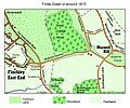
Fortis Green 1815.jpg 1,361 × 1,133; 569 KB
-
Fortis Green Ward map.jpg 779 × 1,079; 533 KB
-
Haringey in Greater London.svg 1,425 × 1,140; 1.39 MB
-
Haringey London UK blank ward map 2022.svg 512 × 398; 983 KB
-
Haringey London UK blank ward map.svg 1,425 × 1,101; 377 KB
-
Haringey London UK labelled ward map 2002.svg 1,319 × 888; 83 KB
-
Haringey London UK location map.svg 1,425 × 1,101; 3.07 MB
-
Haringey wards with Noel Park highlighted.jpg 460 × 271; 44 KB
-
Haringeywardmap.gif 460 × 271; 24 KB
-
Hornsey 1961.png 1,423 × 1,503; 77 KB
-
Hornsey1961.svg 543 × 550; 25 KB
-
LondonHaringey.svg 962 × 744; 19 KB
-
Lordship House, Tottenham 1619.jpg 466 × 431; 198 KB
-
OSM Fortismere School site plan.png 919 × 871; 235 KB
-
Tottenham 1961.png 1,431 × 1,503; 77 KB
-
Tottenham1961.svg 543 × 550; 25 KB
-
Wood green 1961.png 1,269 × 1,306; 63 KB
-
Woodgreen1961.svg 543 × 550; 25 KB


