Category:Maps of the London Borough of Hammersmith and Fulham
Jump to navigation
Jump to search
Subcategories
This category has only the following subcategory.
Media in category "Maps of the London Borough of Hammersmith and Fulham"
The following 15 files are in this category, out of 15 total.
-
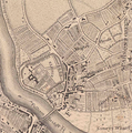
Fulham 1746.png 1,159 × 1,165; 2.92 MB
-
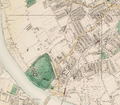
Fulham 1891.png 2,329 × 2,029; 8.63 MB
-
Hammersmith and Fulham London UK blank ward map 2002 to 2022.svg 891 × 1,266; 301 KB
-
Hammersmith and Fulham London UK blank ward map 2022.svg 891 × 1,266; 307 KB
-
Hammersmith and Fulham London UK labelled ward map 2002.svg 797 × 1,266; 68 KB
-
Hammersmith and Fulham London UK location map.svg 891 × 1,266; 2.42 MB
-
Hammersmith and Fulham London UK ward map 1978 to 2002.svg 891 × 1,266; 407 KB
-
Hammersmith and Fulham UK locator map.svg 1,425 × 1,140; 1.06 MB
-
Hammersmith Met. B Ward Map 1916.svg 585 × 1,052; 52 KB
-
LondonHammersmithFulham.png 200 × 155; 23 KB
-
LondonHammersmithFulham.svg 962 × 744; 19 KB
-
ShepherdsBush Davies map 1841.jpg 184 × 193; 95 KB
-
White City, London.png 936 × 397; 746 KB
-
Willesden Junction map with Old Oak Common.png 1,467 × 903; 1.15 MB
-
Willesden junction map.png 1,467 × 903; 1.29 MB


