Category:Maps of the London Borough of Barnet
Jump to navigation
Jump to search
Media in category "Maps of the London Borough of Barnet"
The following 25 files are in this category, out of 25 total.
-
Arnos Park viaduct map.jpg 523 × 616; 176 KB
-
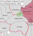
Barnet Civil Parish Map 1863.svg 705 × 769; 573 KB
-
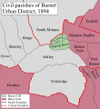
Barnet Civil Parish Map 1894.svg 705 × 769; 578 KB
-
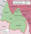
Barnet Civil Parish Map 1935.svg 705 × 769; 628 KB
-
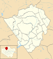
Barnet London UK blank ward map 2002 to 2022.svg 1,131 × 1,266; 651 KB
-
Barnet London UK blank ward map 2022.svg 1,131 × 1,266; 643 KB
-
Barnet London UK labelled ward map 2002.svg 1,025 × 1,160; 158 KB
-
Barnet London UK location map.svg 1,131 × 1,266; 1.78 MB
-
Barnet UK locator map.svg 1,425 × 1,140; 1.06 MB
-
Dollis Brook Viaduct map.png 503 × 301; 242 KB
-
East Barnet Civil Parish Map 1935.svg 609 × 762; 576 KB
-
East Barnet Valley Civil Parish Map 1863.svg 609 × 762; 533 KB
-
East Barnet Valley Civil Parish Map 1894.svg 609 × 762; 560 KB
-
Edgware stations, 1937.jpg 1,000 × 761; 640 KB
-
Extract of 1930 map of Edgware.png 627 × 416; 141 KB
-
Finchley MB Ward Map 1950s.svg 663 × 1,159; 47 KB
-
Finchley UD ward map 1930s.svg 560 × 1,159; 42 KB
-
Finchley1961.svg 543 × 550; 25 KB
-
Friern barnet 1961.png 1,458 × 1,503; 78 KB
-
Friernbarnet1961.svg 543 × 550; 25 KB
-
Hendon MB Ward Map 1950s.svg 861 × 1,052; 81 KB
-
Hendon rural 1911.png 1,027 × 877; 31 KB
-
Hendon1961.svg 543 × 550; 25 KB
-
LondonBarnet.svg 962 × 744; 22 KB
-
Whetstone, London - map 1.png 540 × 360; 211 KB

